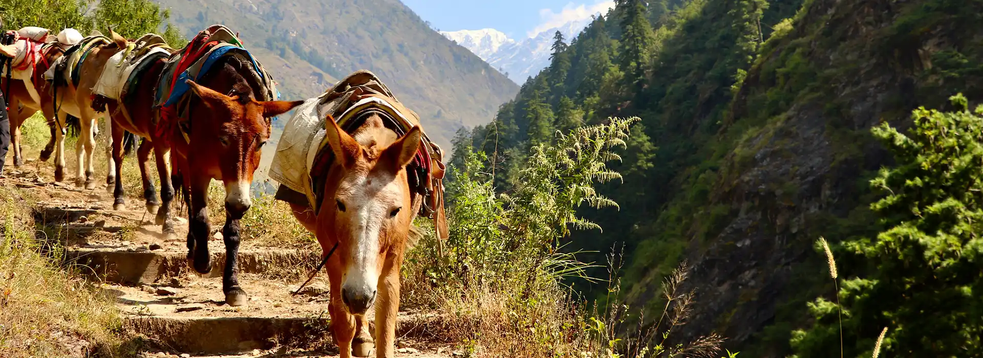
Altitude defines the Manaslu Trek more than distance or trail condition. The route climbs from around 700 meters near Machha Khola to over 5,100 meters at Larkya La Pass. That altitude gain tests every trekker, regardless of fitness level. A solid altitude guide for Manaslu Trek planning helps you pace your days, recognize risk zones, and protect your health. The Manaslu Circuit crosses remote terrain with limited rescue access. Lodges grow simpler at higher elevations.
Cold nights and thin air compound the challenge. Strong legs alone do not guarantee a safe crossing. Proper acclimatization, smart daily pacing, and honest symptom reporting make the real difference. The sections below break down all the details you need: daily sleeping elevations, key acclimatization stops, risk zones, safety tips, and a comparison with other Nepal treks.
Quick Answer: Manaslu Trek Altitude Summary
The Manaslu Trek reaches its highest point at Larkya La Pass, commonly listed at 5,106-5,160 m. Altitude risk increases after Samagaun and Samdo. Trekkers should follow a gradual ascent, take an acclimatization day in Samagaun, walk slowly, avoid alcohol at altitude, and report symptoms early to their guide. General altitude guidance recommends a gradual ascent above 3,000 m. Increase sleeping altitude by no more than 500 m per day. Add an acclimatization day for every 1,000 m of altitude gain during sleep.
Manaslu Trek Altitude at a Glance
Before reading the full breakdown, check the essential altitude facts below.
| Altitude Detail | Information |
|---|---|
| Highest Point | Larkya La Pass, around 5,106 m to 5,160 m (16,750 ft to 16,929 ft) |
| Highest Sleeping Point | Dharamsala / Larkya Phedi, around 4,460 m (14,632 ft) |
| Key Acclimatization Stop | Samagaun, around 3,530 m (11,581 ft) |
| Main Risk Zone | Samagaun to Larkya La Pass |
| Starting Elevation | Machha Khola, around 870 m (2,854 ft) |
| Total Trek Duration | 14 to 18 days (depending on pace and rest days) |
| Best Safety Strategy | Slow ascent, rest day in Samagaun, symptom monitoring, guide support |
Note: Altitude figures vary slightly between maps, GPS devices, and trekking operators. Always verify numbers with your guide and agency.
Highest Point on the Manaslu Trek
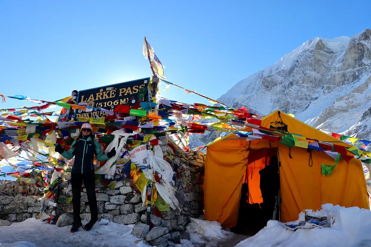
Larkya La Pass marks the highest point on the Manaslu Circuit. Most sources list the pass between 5,106 m and 5,160 m. Trekkers cross the pass on a single long day but do not sleep at this elevation. The crossing demands an early morning start and takes 8 to 10 hours from Dharamsala to Bimthang.
Highest Sleeping Altitude
Dharamsala (also called Larkya Phedi) is the highest point for sleeping. It sits around 4,460 m. The night before the pass crossing, trekkers rest here in basic shelters. Cold temperatures drop below freezing. A warm sleeping bag rated to minus 15 degrees Celsius helps.
Main Altitude Risk Zone
The risk zone extends above Samagaun (3,530 m) and includes Samdo (3,860 m), Dharamsala (4,460 m), and Larkya La Pass. Altitude sickness symptoms often appear in this zone. The body works hard to adjust. Trekkers need extra water, a slower pace, and honest communication with their guide.
Best Acclimatization Stop
Samagaun stands as the single most important acclimatization stop on the route. A two-night stay here gives the body time to adjust before the push to higher camps. Skip the rest day in Samagaun, and the risk of altitude sickness rises sharply above Samdo.
Altitude defines the Manaslu Trek more than distance or trail condition. The route climbs from around 700 meters near Machha…
Why Altitude Matters on the Manaslu Trek
Remote Trail Conditions
The Manaslu Circuit enters the Manaslu Restricted Area. Trail sections run through deep gorges, narrow valleys, and high glacial terrain. Phone signals disappear in many areas. Medical clinics do not exist along the upper route. A helicopter evacuation takes time to arrange and depends on the weather. Every altitude decision carries more weight on a remote trail. A mild headache at 4,000 m in a busy trekking area stays minor. The same headache on the remote Manaslu route needs immediate attention, as help is hours away.
Long Distance Between Villages
Above Samagaun, villages grow smaller and farther apart. The distance between Samdo and Dharamsala takes a full walking day. Between Dharamsala and Bimthang (over the pass), trekkers walk 8 to 10 hours across high, exposed terrain. Turning back from midway through a pass crossing creates serious logistical problems. Good acclimatization before the push reduces the chance of a forced retreat.
Why Fitness Alone Does Not Prevent Altitude Sickness
Altitude sickness affects fit and unfit people alike. A marathon runner and a casual walker face the same thin air above 4,000 m. The body responds to reduced oxygen pressure, not muscle strength. Young, strong trekkers sometimes push too fast because they feel invincible. That overconfidence leads to trouble. Altitude rewards patience, not speed. Walk slowly. Rest often. Drink water. Listen to your body.
Manaslu Trek Elevation Profile by Day
The Manaslu Circuit altitude profile is divided into five zones. Each zone puts different demands on the body.
Low Valley Section: Machha Khola to Jagat
The trek starts in the Budhi Gandaki Valley at around 870 m. The first two days climb gradually through subtropical forest, river gorges, and small villages. Sleeping altitude stays below 1,400 m. Altitude sickness is not a concern here, but the walking builds rhythm and tests gear.
Middle Elevation Section: Deng to Lho
Between Deng (1,860 m) and Lho (3,180 m), the route gains significant height over several days. The air starts to feel thinner. Nights grow colder. Trekkers notice harder breathing on uphill sections. The body begins its altitude adjustment during these middle days. Pace control matters here. Walking too fast through the middle zone creates problems farther up the route. Good guides monitor the group and slow the pace if anyone shows early signs of strain.
Acclimatization Zone: Samagaun and Samdo
Samagaun (3,530 m) and Samdo (3,860 m) form the acclimatization heart of the trek. Most well-planned itineraries include a rest day in Samagaun. Some add an extra night in Samdo for cautious trekkers. The body does its most important altitude adjustment here. Red blood cell production increases. Breathing patterns change. Sleep quality drops slightly — a normal response. Trekkers should eat well, drink plenty of water, and avoid overexertion.
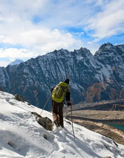
High-Risk Zone: Dharamsala and Larkya La Pass
Dharamsala (4,460 m) is the highest point on the trek. The night feels cold, uncomfortable, and restless for many. The next morning, trekkers wake before dawn and begin the crossing of Larkya La Pass. Larkya La sits above 5,100 m. The thin air, cold wind, and long day combine to create the hardest section of the entire trek. Good acclimatization in the days before makes this crossing manageable. Poor preparation makes it dangerous.
Descent Zone: Bimthang to Dharapani
After crossing Larkya La, trekkers descend rapidly to Bimthang (3,590 m). The drop in altitude brings immediate relief. Breathing feels easier. Energy returns. The remaining days take the trail down through Tilije and Dharapani toward a lower elevation. Altitude risk drops quickly during the descent. The main concern shifts to tired legs, rocky trails, and the emotional comedown after the big pass day.
Day-by-Day Altitude Table for Manaslu Trek
Standard Manaslu Circuit Altitude Plan
The table below shows a standard 14-day Manaslu Circuit trek itinerary, including sleeping altitudes, daily elevation changes, and risk levels.
| Day | Route | Sleeping Alt. | Elev. Change | Risk Level | Safety Note |
|---|---|---|---|---|---|
| 1 | Drive to Machha Khola | ~870 m | N/A | None | Road travel: prepare gear |
| 2 | Trek to Jagat | ~1,340 m | +470 m | None | Easy river valley walk |
| 3 | Trek to Deng | ~1,860 m | +520 m | None | Trail enters gorge terrain |
| 4 | Trek to Namrung | ~2,630 m | +770 m | Low | First noticeable altitude gain |
| 5 | Trek to Lho | ~3,180 m | +550 m | Low–Med | Breathing feels different; slow pace |
| 6 | Trek to Samagaun | ~3,530 m | +350 m | Medium | Key acclimatization village ahead |
| 7 | Rest in Samagaun | ~3,530 m | 0 | Recovery | Acclimatization day; short hike optional |
| 8 | Trek to Samdo | ~3,860 m | +330 m | Medium | Monitor headache, appetite, energy |
| 9 | Trek to Dharamsala | ~4,460 m | +600 m | High | Highest sleeping point; cold night |
| 10 | Cross Larkya La to Bimthang | ~3,590 m | +700/−1,570 m | Highest | Pass day; start before dawn |
| 11 | Trek to Tilije | ~2,300 m | −1,290 m | Low | Relief; tired legs |
| 12 | Trek to Dharapani | ~1,860 m | −440 m | None | Valley walk; drive option |
| 13 | Drive to Kathmandu/Pokhara | N/A | N/A | None | Return travel |
| 14 | Buffer / Departure | N/A | N/A | None | Extra day for delays |
Altitude figures shown as approximate. Your operator may use slightly different numbers.
Safer Slow-Paced Altitude Plan
A 16-day plan adds two extra acclimatization days for cautious trekkers:
- Extra rest day in Samagaun (two full rest days total)
- Extra night in Samdo before moving to Dharamsala
The slower plan gives more time to adjust to altitudes between 3,500 m and 4,500 m. Older trekkers, first-time altitude visitors, and anyone with past altitude problems benefit most from the extended schedule.
Where to Add Extra Rest Days
- Samagaun: Priority. Two nights minimum.
- Samdo: Second priority. Add a rest day if headaches or poor sleep persist.
- Namrung or Lho: Third priority. Useful for trekkers who gain altitude fast.
Adding rest days costs extra time and lodge fees. The trade-off saves health and protects the entire trip investment. A rushed schedule puts the pass crossing at risk.
Key Altitude Points on the Manaslu Trek
Machha Khola — Approx. 870 m (2,854 ft)
The trek starts here after a long drive from Kathmandu. The Budhi Gandaki River runs alongside the village. Altitude poses no concern. Trekkers adjust to trail life, test gear, and settle into walking rhythm.
Jagat — Approx. 1,340 m (4,396 ft)
Jagat sits at a Manaslu restricted area checkpoint. Permit checks happen here. The village marks the entry into the restricted zone. Altitude stays comfortable. The walk from Machha Khola follows the river gorge terrain with some steep steps.
Deng — Approx. 1,860 m (6,102 ft)
Deng lies in a narrow valley. The trail passes through forest and rock faces. Altitude remains easy for most trekkers. The village stays small and quiet. Lodges offer simple rooms and warm meals.
Namrung — Approx. 2,630 m (8,629 ft)
Namrung delivers the first real altitude gain. Trekkers notice the climb. Tibetan Buddhist influence appears in mani walls and prayer flags. The village sits on a hillside with mountain views. Sleep should still come easily at this height.
Lho — Approx. 3,180 m (10,433 ft)
Lho offers the first serious altitude experience. Mount Manaslu appears on the skyline. The monastery in Lho welcomes visitors. Breathing feels slightly heavier on uphill sections. Walking pace should drop. Hydration matters more from now on.
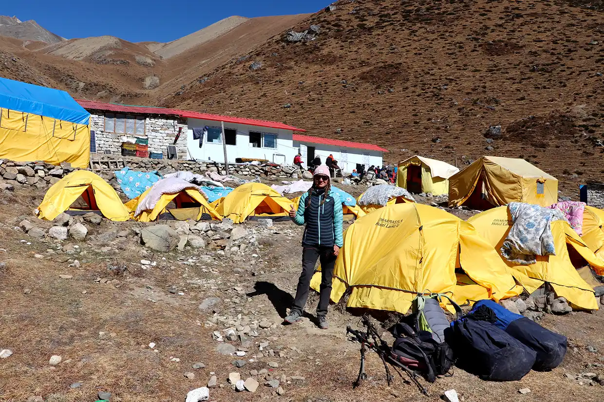
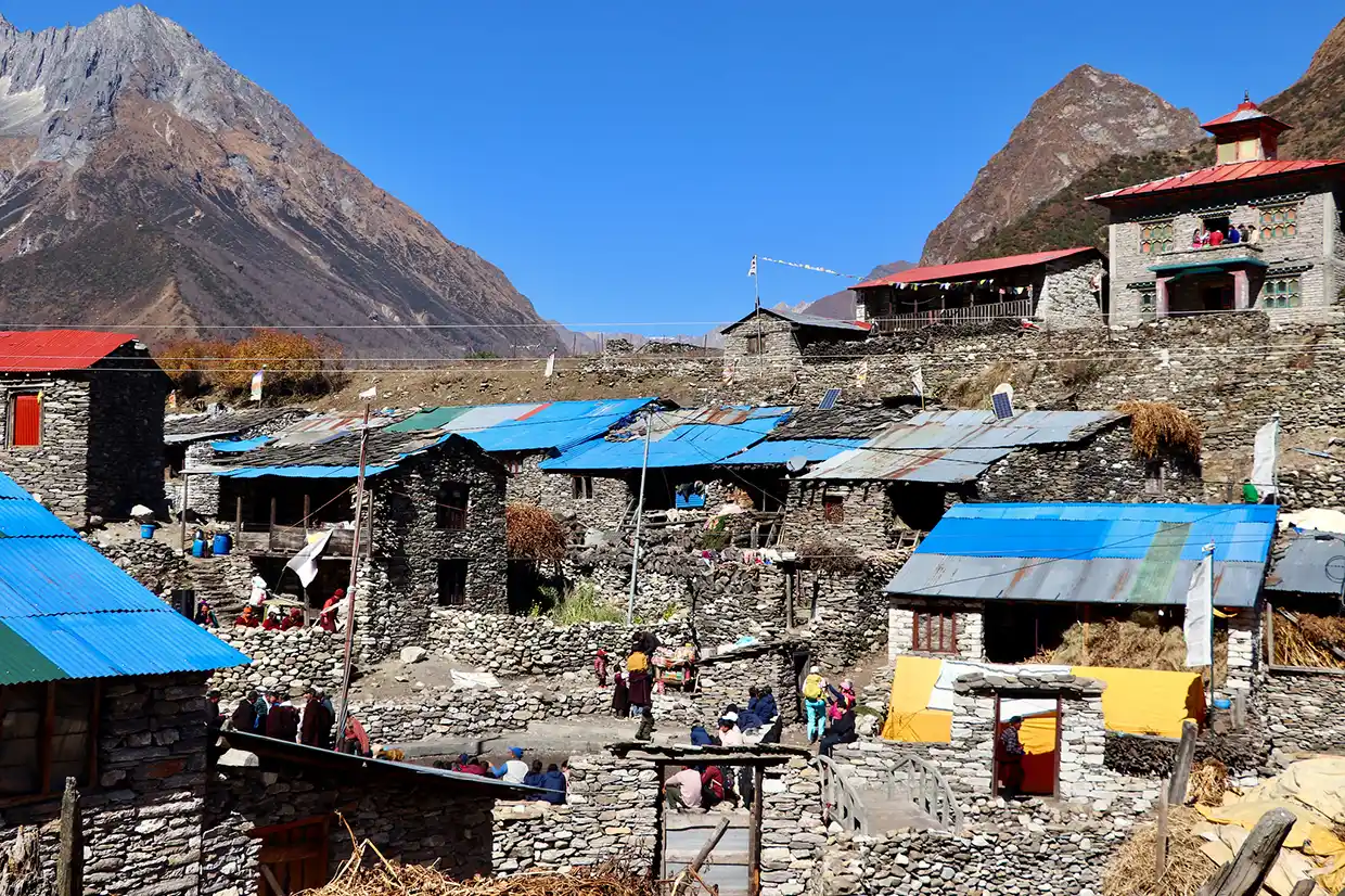
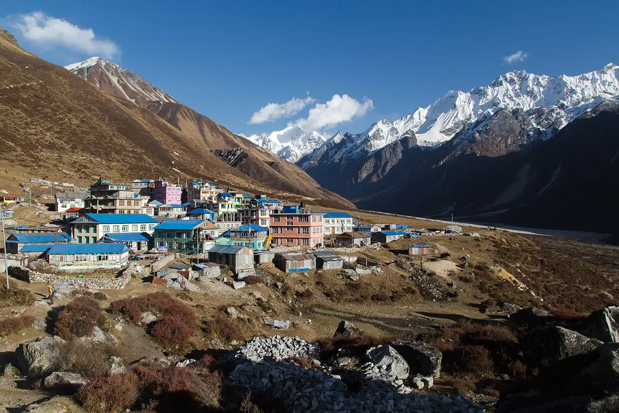
Samagaun — Approx. 3,530 m (11,581 ft)
Samagaun serves as the most important acclimatization stop on the Manaslu Trek. Most safe itineraries spend two nights here before moving higher. The village has the best lodges in the upper route. Trekkers should rest, hydrate, eat well, and take only a gentle acclimatization hike if they feel strong.
Samdo — Approx. 3,860 m (12,664 ft)
Samdo sits near the Tibetan border. The air feels thin. Cold settles in early each evening. Some trekkers experience mild headaches here. Appetite drops for a few. A good sign means your body adjusts. A bad sign means symptoms grow worse overnight. Report any trouble to your guide.
Dharamsala — Approx. 4,460 m (14,632 ft)
Dharamsala (Larkya Phedi) marks the highest point for sleeping. The shelter offers basic stone or tin rooms. No luxury exists here. Cold temperatures demand warm layers and a strong sleeping bag. The next morning marks the start of the Larkya La crossing. Sleep often comes poorly at this altitude — a normal response.
Larkya La Pass — Approx. 5,106 m to 5,160 m (16,750 ft to 16,929 ft)
Larkya La Pass crowns the Manaslu Circuit. Trekkers reach the top after a steep morning climb. Prayer flags mark the summit. Views stretch across glacial peaks. The thin air limits energy. The descent to Bimthang runs long and steep. No one sleeps at the pass.
Bimthang — Approx. 3,590 m (11,778 ft)
Bimthang greets trekkers after the pass with alpine meadows and mountain views. The altitude drop from Larkya La brings physical relief. Most trekkers feel a surge of energy and appetite. The hardest altitude challenge sits behind you at Bimthang.
Why Samagaun Stands as the Most Important Acclimatization Stop
Two-Night Stay in Samagaun
A two-night stay gives your body nearly 48 hours at 3,530 m before pushing higher. During the rest day, red blood cell production increases. Breathing efficiency improves. The body learns to operate with less oxygen. Skipping the rest day in Samagaun saves one day on the itinerary. But it dramatically raises the risk of altitude sickness between Samdo and Dharamsala. That trade-off rarely makes sense.
Optional Acclimatization Hikes
On the rest day, trekkers take a short hike above Samagaun and return to sleep at the same elevation. Common options include a walk to Birendra Tal (a glacial lake) or a walk up a hillside above the village with views of Manaslu. The hike should feel gentle. Do not exhaust yourself. The goal: gain a few hundred meters of altitude during the day, then sleep low. Return to the lodge by early afternoon. Rest, eat, and drink water.
Climb High, Sleep Low Strategy
“Climb high, sleep low” summarizes the safest approach to acclimatization. Walk to a higher point during the day, then return to a lower sleeping elevation. The body gains altitude exposure without the stress of sleeping at the new height. Samagaun supports this strategy perfectly. Trekkers hike 200 to 400 meters above the village, then return. The next morning, the walk to Samdo feels easier because the body has already sampled that altitude range.
Larkya La Pass Altitude and Difficulty
Why Larkya La Feels Hard
Larkya La Pass, at an altitude of 5,100 m, takes trekkers above that mark. The air holds roughly 50% of the oxygen available at sea level. Every step demands more effort. The body burns more energy to maintain normal function. Even well-acclimatized trekkers feel the strain. The pass also involves a long day. The drive from Dharamsala to Bimthang typically takes 8 to 10 hours. The climb to the pass runs steeply. The descent to Bimthang runs long and rocky.
Early Morning Start
Most groups leave Dharamsala between 3:00 AM and 5:00 AM. The early start ensures trekkers reach the pass before the afternoon wind and cloud roll in. Walking in darkness with headlamps feels cold and disorienting at first. Once the sun rises and the pass appears, energy lifts.
Weather, Wind, Snow, and Cold
Weather controls the Larkya La crossing. Clear mornings allow safe passage. Heavy snow, dense fog, or strong winds can delay flights. Your guide makes the final call on whether to attempt the crossing. Trust that decision. A delayed crossing beats a dangerous one. Temperatures at the pass drop well below freezing. Wind chill pushes the feel even colder. Wear layers: thermal base, insulating mid-layer, windproof outer shell. Protect hands, face, and ears.
Why You Do Not Sleep at the Pass
No shelter exists at Larkya La. The pass sits on an exposed ridge with no water, no warmth, and no protection. Trekkers cross and descend. Sleeping at this altitude without proper facilities creates an extreme health risk. The descent to Bimthang (3,590 m) brings the body back to a safer sleeping elevation.
Altitude Sickness on the Manaslu Trek
Altitude sickness (Acute Mountain Sickness or AMS) occurs when the body struggles to adjust to reduced oxygen at higher elevations. It affects trekkers of all fitness levels.
Common AMS Symptoms
- A headache that does not go away with water and rest
- Nausea or loss of appetite
- Dizziness or lightheadedness
- Poor sleep or waking frequently at night
- Unusual fatigue beyond normal tiredness
- Mild shortness of breath during rest
Warning Signs That Need Urgent Action
- Severe headache that worsens despite rest
- Vomiting or inability to eat or drink
- Confusion or difficulty thinking clearly
- Loss of coordination or a stumbling walk
- Breathlessness at rest (possible sign of HAPE — high-altitude pulmonary edema)
- Extreme drowsiness or unusual behavior (possible sign of HACE — high-altitude cerebral edema)
HAPE and HACE require immediate descent and medical attention. Do not wait for symptoms to improve at altitude.
What to Tell Your Guide
Report every symptom, even mild ones. A slight headache at 3,800 m matters more than the same headache at sea level. Your guide monitors the group and makes safety decisions based on honest feedback. Do not hide symptoms to avoid slowing the group. A delayed report turns a minor problem into a serious emergency. Guides carry pulse oximeters to check oxygen saturation. They adjust pace, add rest, or recommend descent based on readings.
When Descent Becomes Necessary
Descent remains the single most effective treatment for altitude sickness. If symptoms worsen after rest and hydration, moving to a lower elevation brings relief. A drop of 300 to 500 meters often produces noticeable improvement within hours. On the Manaslu route, descent options depend on location. Below Dharamsala, returning to Samdo or Samagaun works. Above Dharamsala during the pass crossing, the group pushes over and descends to Bimthang. Your guide decides the safest direction.
| Symptom | Severity | Recommended Response |
|---|---|---|
| Mild headache | Low | Rest, drink water, monitor |
| Persistent headache | Medium | Rest day, slow pace, guide check |
| Nausea or appetite loss | Medium | Eat light food, hydrate, and report to guide |
| Dizziness | Medium–High | Stop climbing, rest, guide assessment |
| Poor coordination | High | Descend immediately with the guide |
| Breathlessness at rest | High | Descend immediately; possible HAPE |
| Confusion or extreme drowsiness | Critical | Emergency descent; possible HACE |
Best Acclimatization Plan for Manaslu Trek
Safe Ascent Above 3,000 m
Once above 3,000 m, increase sleeping altitude by no more than 500 m per day. Add 1 acclimatization day for every 1,000 m of altitude gain during sleep. The Manaslu route naturally supports this pace when trekkers follow a standard 14- to 16-day itinerary.
Rest Day in Samagaun
Spend at least two nights in Samagaun. Use the rest day for a gentle acclimatization hike. Return to the village by early afternoon. Eat hearty meals. Drink at least 3 to 4 liters of safe water. Avoid alcohol. Sleep early.
Optional Extra Night in Samdo
Trekkers who feel tired, headachy, or low on appetite after arriving in Samdo should add an extra night. The body needs time. Rushing from Samdo to Dharamsala while symptomatic creates a serious risk at the highest sleeping point.
Why a Rushed Itinerary Increases Risk
Some operators offer 12-day Manaslu itineraries that skip rest days or compress walking stages. These plans save time but ignore altitude safety. The human body does not adjust faster just because the schedule demands it. A rushed trek raises the chance of altitude sickness at Dharamsala and the pass. It also reduces enjoyment. Choose an itinerary that respects your body over one that races toward the finish.
Acclimatization Tips Summary
- Walk slowly from day one, even when the trail feels easy
- Sleep at gradual elevations; avoid big altitude jumps
- Take the rest day in Samagaun seriously
- Add a rest day in Samdo if symptoms appear
- Avoid alcohol above 3,000 m
- Drink safe, treated water throughout the day
- Eat enough calories even when your appetite drops
- Tell your guide about symptoms early and honestly
- Descend if symptoms worsen despite rest
Manaslu Trek Altitude Compared with Other Nepal Treks
Understanding where Manaslu fits among other popular Nepal treks helps set realistic expectations.
| Trek | Highest Point | Highest Sleep Alt. | Acclimatization Stops | Overall Altitude Difficulty |
|---|---|---|---|---|
| Manaslu Circuit | Larkya La ~5,106–5,160 m | Dharamsala ~4,460 m | Samagaun, Samdo | Hard |
| Annapurna Circuit | Thorong La ~5,416 m | Thorong Phedi ~4,525 m | Manang | Moderate–Hard |
| Everest Base Camp | Kala Patthar ~5,545 m | Gorak Shep ~5,164 m | Namche, Dingboche | Hard |
| Langtang Valley | Kyanjin Ri ~4,773 m | Kyanjin Gompa ~3,870 m | Kyanjin Gompa | Moderate |
Manaslu Trek vs Annapurna Circuit
Annapurna Circuit crosses Thorong La Pass at roughly 5,416 m — higher than Larkya La. Annapurna offers better lodge support and more exit points. Manaslu feels harder due to remote terrain, basic lodges, and fewer rescue options. Both demand proper acclimatization above 3,500 m.
Manaslu Trek vs Everest Base Camp Trek
Everest Base Camp reaches higher sleeping altitudes (Gorak Shep at 5,164 m). The EBC route has better medical support at altitude through the Himalayan Rescue Association clinic in Pheriche. Manaslu has no equivalent clinic. Both treks need 14 or more days and strong altitude planning.
Manaslu Trek vs Langtang Valley Trek
Langtang Valley stays lower and shorter. The highest optional point (Kyanjin Ri) reaches about 4,773 m. Langtang suits trekkers who want a taste of high altitude without the full commitment of a circuit trek. Manaslu demands more days, higher passes, and stronger preparation.
Who Should Take Extra Care with Altitude?
First-Time High-Altitude Trekkers
Your body has no altitude history. You do not know how it responds above 3,500 m. Start slow. Rest well. Monitor every symptom. A guided trek with a licensed guide gives first-timers the best safety margin.
Trekkers Over 50
Age alone does not predict altitude sickness. Many trekkers over 50 complete Manaslu safely. Recovery time increases with age. Add an extra rest day in the plan. Carry proper medication after consulting your doctor before the trip.
Travelers with Past Altitude Problems
Anyone who experienced altitude sickness on a previous trek faces a higher risk on Manaslu. The same altitude range triggers similar responses. Plan a slower itinerary. Add extra rest days. Discuss altitude medication options with your doctor before departure.
Travelers with Medical Conditions
Heart conditions, lung problems, high blood pressure, and sleep apnea all affect altitude tolerance. Consult your doctor before booking. Get written medical clearance. Share your medical history with your trekking agency and guide before the trek starts.
Fitness and Preparation for Manaslu Altitude
Cardio Training
Build a strong aerobic base 8 to 12 weeks before the trek. Walk, hike, run, swim, or cycle at moderate intensity for 45 to 60 minutes per session. Train at least 4 times per week. Cardio fitness helps the body use oxygen more efficiently at altitude.
Strength and Endurance
Strengthen legs, core, and back. Squats, lunges, step-ups, and planks build trekking-specific strength. Carry a loaded backpack (8-12 kg) on training hikes to prepare for real trail conditions. Build leg endurance for 6- to 8-hour walking days.
Slow Walking Practice
Practice walking at a slow, steady pace on hilly terrain. High-altitude trekking rewards slow walkers. Train your body and mind to accept a pace that feels almost too easy at low elevation. That pace saves energy and reduces altitude stress above 4,000 m.
Mental Preparation for Long Days
The pass day runs 8 to 10 hours. Some walking days last 6 to 7 hours on rough terrain. Mental stamina matters as much as physical strength. Practice long hikes at home. Build comfort with early mornings, cold starts, and hours of continuous effort.
Safety Equipment and Guide Support
Pulse Oximeter Checks
A pulse oximeter measures oxygen saturation in the blood. Licensed guides carry one and check readings at altitude camps. A reading below 85% at rest signals concern—readings below 75% demand immediate action. Regular checks catch problems before symptoms grow severe.
Emergency Oxygen
Reputable trekking agencies carry portable emergency oxygen on the Manaslu route. The oxygen helps stabilize a trekker while the team arranges descent or evacuation. Emergency oxygen does not replace descent — it buys time.
First Aid and Communication
Guides carry first-aid kits with altitude-specific supplies. Satellite phones or emergency communication devices provide contact with the agency base office and rescue services. Check that your operator has the necessary communication equipment before departure.
Travel Insurance and Evacuation Planning
Every Manaslu trekker needs travel insurance that covers high-altitude trekking and helicopter evacuation. Verify that your policy covers altitude up to 6,000 m. Check the claim process. Carry a printed copy of your policy and emergency contact numbers. Helicopter evacuation from the Manaslu region depends on weather, daylight, and landing conditions. Insurance does not guarantee instant rescue. It provides financial coverage for the rescue cost, which runs into thousands of dollars.
Best Time for Manaslu Trek Altitude Safety
| Season | Conditions | Altitude Safety | Best For |
|---|---|---|---|
| Spring (Mar–May) | Warming days, rhododendrons, some haze | Good, stable weather helps pass crossing | Trekkers who enjoy spring scenery and warmer temps |
| Autumn (Sep–Nov) | Clear skies, best visibility, peak season | Best, driest, and most stable conditions | Most trekkers; safest overall pass conditions |
| Winter (Dec–Feb) | Very cold, snow risk, short days | Higher risk; snow blocks Larkya La | Experienced winter trekkers only |
| Monsoon (Jun–Aug) | Rain, leeches, landslide risk, clouds | High risk; trail damage, poor visibility | Not recommended for the standard Manaslu Circuit |
Spring Conditions
Spring brings warmer days and rhododendron blooms at lower elevations. Snow starts to melt on the pass. Late March through May offers good trekking conditions. Some morning haze limits mountain views at lower altitudes, but conditions improve above 3,000 m.
Autumn Conditions
Autumn (September through November) delivers the clearest skies and most stable weather. The Larkya La crossing carries the lowest weather risk. Most trekkers and agencies prefer autumn for the Manaslu trek. Peak permit costs apply during these months.
Winter Snow Risk
Heavy snow covers Larkya La during the winter months. The pass becomes impassable after large storms. Rescue access drops further. Only experienced winter trekkers with strong guide support should consider an attempt from December to February.
Monsoon Trail Risk
Rain, leeches, landslides, and river crossings make the monsoon season risky. Trail sections wash out. Clouds block mountain views. The standard Manaslu Circuit is not suitable for marvel. During the monsoon, some experienced trekkers attempt it, but the risk-to-reward ratio remains poor.
Common Altitude Mistakes to Avoid
- Skipping the rest day in Samagaun to save time
- Walking too fast in the middle elevation zone
- Drinking alcohol above 3,000 m
- Hiding symptoms from the guide
- Taking altitude medication without consulting a doctor first
- Choosing a 12-day itinerary that compresses rest days
- Ignoring early signs of headache, nausea, or dizziness
- Refusing to descend when symptoms worsen
- Carrying too much weight in a personal backpack
- Failing to drink enough water throughout the day
Final Safety Checklist Before the Manaslu Trek
- Choose a 14- to 16-day itinerary with a rest day in Samagaun
- Get a medical checkup and altitude clearance from your doctor
- Buy travel insurance that covers altitude up to 6,000 m and helicopter evacuation
- Train cardio and leg strength 8 to 12 weeks before departure
- Pack a sleeping bag rated to minus 15 degrees Celsius or colder
- Carry warm layers for Dharamsala and Larkya La: thermal base, fleece, down jacket, windproof shell
- Bring a headlamp with extra batteries for the early pass-day start
- Confirm your operator carries emergency oxygen, a pulse oximeter, and satellite communication
- Print your insurance policy and emergency contact numbers
- Discuss altitude medication with your doctor before the trip
- Learn basic AMS symptoms and report them to your guide immediately
- Stay flexible; weather and health always override the schedule
FAQs: Altitude Guide for Manaslu Trek
Q: What altitude does the Manaslu Trek reach at its highest point?
A: The trek reaches its highest elevation at Larkya La Pass, which stands between 5,106 and 5,160 meters. Trekkers navigate this demanding pass in a single day rather than sleeping at the top. Meanwhile, the highest overnight stay occurs at Dharamsala at 4,460 meters. This single-day crossing features thin air and cold winds, demanding solid physical endurance from everyone.
Q: How common is altitude sickness on the Manaslu Trek?
A: Mild altitude symptoms like headaches, poor sleep, and reduced appetite frequently affect trekkers once they ascend above 3,500 meters. However, serious health cases remain quite uncommon on this route. Hikers can significantly minimize their risks by committing to a gradual ascent plan, incorporating proper rest days, and relying on close monitoring from their licensed mountain guide throughout the journey.
Q: How high does Larkya La Pass stand?
A: Larkya La Pass stands between 5,106 meters and 5,160 meters, marking the absolute highest point on the Manaslu Circuit. Crossing this exposed pass from Dharamsala to Bimthang takes roughly eight to ten hours of continuous walking. Due to the combination of freezing winds and thin mountain air, this specific day stands out as the most physically demanding part of the trek.
Q: What serves as the highest sleeping altitude on the Manaslu Trek?
A: Dharamsala, which is also known locally as Larkya Phedi, serves as the highest overnight stop at 4,460 meters. Trekkers spend just one night here before tackling the pass crossing the following morning. Because the basic shelters offer minimal physical comfort, carrying a high-quality, cold-rated sleeping bag and wearing plenty of warm layers are essential to staying comfortable.
Q: How many acclimatization days does the Manaslu Trek need?
A: At a bare minimum, you should plan one full acclimatization rest day in the village of Samagaun. Cautious travelers often choose to add a second rest day there or schedule an extra night in Samdo. Opting for a complete fourteen to sixteen-day itinerary ensures your body receives enough time to adjust safely to the increasingly high-altitude conditions.
Q: Why does Samagaun matter for acclimatization?
A: Sitting at roughly 3,530 meters, Samagaun serves as the critical gateway to the high-altitude zone. Spending a dedicated rest day in this village allows your body to adjust to the thinning air before you push higher up to Samdo and Dharamsala. Skipping this vital rest stop significantly increases your overall risk of developing altitude sickness at the upcoming camps.
Q: Does the Manaslu Trek feel harder than the Annapurna Circuit?
A: Yes, most hikers find Manaslu more difficult due to its remote terrain, basic lodges, fewer trail exits, and limited emergency rescue access. While the Annapurna Circuit actually crosses a higher point at Thorong La, it provides much better tourism infrastructure and flexible route options. This lack of amenities makes the wilderness experience on the Manaslu Circuit feel significantly more rugged.
Q: Does the Manaslu Trek suit beginners?
A: The circuit can suit fit beginners provided they prepare thoroughly, pick a slower itinerary, and hike alongside a licensed guide. Having prior multi-day trekking experience is a huge advantage during preparation. First-time altitude travelers should intentionally add extra rest days to their schedule and carefully monitor their physical symptoms as they ascend into higher elevations.
Q: What should I do if altitude symptoms appear?
A: You must report any symptoms to your trekking guide immediately, stop ascending, rest, and drink plenty of water. If your symptoms do not improve after a period of rest, you need to descend to a lower elevation right away. You must never continue climbing higher if you are experiencing a worsening headache, nausea, dizziness, or mental confusion.
Q: Do I need Diamox (acetazolamide) for the Manaslu Trek?
A: You should always consult with your personal doctor before taking any preventative altitude medications. While acetazolamide helps some trekkers acclimatize faster, it has specific side effects and is not suitable for everyone. A medical professional will properly assess your health background to recommend the correct dosage and timing for your high-altitude trip.
Q: Do I need travel insurance for the Manaslu Trek?
A: Yes, carrying comprehensive travel insurance is a mandatory requirement for every trekker on this route. Your policy must explicitly cover high-altitude hiking up to 6,000 meters and include emergency helicopter evacuation services. Make sure to verify the claim process beforehand and keep a printed copy of your policy documents in your pack during the trek.
Q: Which season offers the safest altitude conditions for the Manaslu Trek?
A: Autumn provides the safest overall altitude conditions, delivering beautifully clear skies and stable mountain weather from September through November. The spring season from March to May ranks as the second-best option. Conversely, winter introduces dangerous heavy snow at Larkya La Pass, while the summer monsoon creates severe trail hazards and very poor visibility.