

Kathmandu – Beni – Dharapani – Italian Base Camp – Dhaulagiri Base Camp – French Pass – Dhampus Pass – Jomsom – Pokhara – Kathmandu

Unbeatable Holiday Offers – Save Up to 20% on Your Next Adventure!

Kathmandu – Beni – Dharapani – Italian Base Camp – Dhaulagiri Base Camp – French Pass – Dhampus Pass – Jomsom – Pokhara – Kathmandu
The Dhaulagiri Circuit Trek is a challenging 20-day trek through one of Nepal’s most remote mountain areas. The trek circles the world’s seventh-tallest peak at 8,167m, the giant Dhaulagiri range. You’ll pass through varied landscapes, from rich green lowlands to harsh, high alpine zones.
Your trek begins with a two-day tour of Kathmandu. Here, you will explore historic temples and prepare for the trek. The trek begins with a scenic drive to Beni, the trek’s starting point in the Myagdi Valley. From Beni, the route takes you through diverse terrain, including terraced fields and traditional Magar villages such as Muri and Boghara, steadily climbing higher. Oak and rhododendron forests will gradually give way to open alpine meadows, then to rocky moraines near the mountains. The Italian Base Camp at 3,660m is one of the key acclimatization stops in the trek. After crossing the Italian Base Camp, the trail becomes more rugged and remote. You’ll trek along glaciers and camp surrounded by ice and snow at the Glacier Camp.
The trek’s highest point is Dhaulagiri Base Camp at 4,740m. The camp offers a close-up view of the massive north face of Dhaulagiri I. Its scale and remoteness create a powerful impression on anyone who visits.
Then, the route crosses two high mountain passes, the French Pass at 5,360m, and the Dhampus Pass at 5,200m. The French Pass climb is challenging but rewards you with panoramic views of the Dhaulagiri and Annapurna Range. After crossing the French Pass, you’ll see Hidden Valley, a remote alpine valley above 5,000m known for its quiet and wild atmosphere.
You’ll leave Hidden Pass and descend towards lower altitudes and familiar villages. As you descend, you’ll reach the Kali Gandaki village. Visit the town of Marpha and its apple orchards and meet the Thakali people there.
The trek concludes in Jomsom, where a short flight will take you to Pokhara. You can relax and celebrate your accomplishment after reaching Pokhara. Finally, you’ll drive back to Kathmandu and officially complete the trek.

Included Meals

Trip staff

Transport

Accommodation

Trip Grade
Group Size
You’ll arrive in Kathmandu today. Look for our company’s banner and meet our staff who will transfer you from the airport to your hotel. You can use the rest of the day to rest after the long flight. You can explore some parts of the city to glimpse the countryside. Meet your guide in the evening for a brief orientation and to prepare yourself fully for the trek ahead.
Accommodation:
Hotel Thamel Park or similar
Difficulty
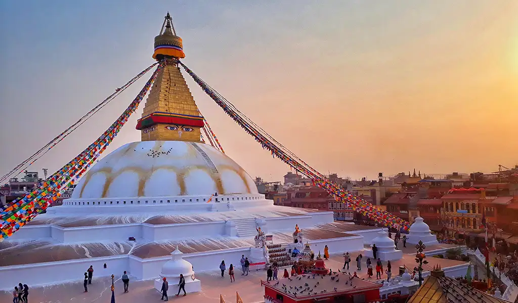
Today is your Kathmandu touring day. You’ll visit a few of Kathmandu’s UNESCO World Heritage Sites. You will see iconic sites like Swayambhunath Stupa, Bouddhanath Stupa, or Pashupatinath Temple and witness the city’s mixture of Hinduism and Buddhism. Today is a great chance to learn and immerse yourself in Nepal’s rich culture and traditions.
 Accommodation:
Hotel Thamel Park or similar
Meals Breakfast
Difficulty
Transportation Private Car
Have an early breakfast and begin your adventure with a long drive to Beni. You’ll travel west from Kathmandu along the Prithvi Highway in a private vehicle and pass through river valleys, terraced rice paddies, and small villages. The bus stops at Pokhara for lunch before continuing to Beni. The lively town of Beni sits at the meeting point of the Kali Gandaki and Myagdi rivers. You’ll stay overnight at a local lodge in Beni.
Altitude change: 1,400 m (Kathmandu) → 820 m (Beni)
Distance: ~280 km (174 miles)
Travel time: ~8–9 hours (including lunch stop)
Accommodation:
Teahosue
Meals Breakfast
Difficulty
Transportation Bus
The trek officially begins today. Have breakfast and set out on your trail with a gentle walk north along the Myagdi Khola. Today, you’ll pass small villages like Mangalaghat, Singa, and Tatopani. Tatopani, which translates to “hot water,” got its name from its nearby hot springs. As you continue through your trek, you will cross a suspension bridge and through lush, terraced farmland. By afternoon, you’ll reach Babiyachaur at 950m. You’ll spend the night in this tiny riverside settlement in a simple teahouse.
Altitude change: 820 m → 1,150 m
Distance: ~10 km (6.2 miles)
Trekking hours: ~4–5 hours
Activity level: Easy to moderate (mostly flat with gentle climbs)
Highlights: Walking along the Myagdi Khola river; visiting villages including Tatopani with hot springs; crossing a suspension bridge; verdant farmland scenery; overnight stay in quiet Babiyachaur

Time & Distance 5 Hours & 10 KM
Accommodation:
Local Teahouse
Meals Breakfast, Lunch, Dinner
Difficulty
Your trek continues along the Myagdi Khola and passes through farming villages and terraced fields. You will start gaining elevation, and the valley begins narrowing, revealing a more rugged landscape. As you continue through the trek, you’ll pass villages of Shahashradhara and Ratorunga, where you can stop for a tea break or have lunch. While the trail takes you through some ups and downs, you don’t need to trek any steep climbs today. You’ll walk alongside the river, making the atmosphere more peaceful. You’ll arrive in Dharapani by late afternoon. This village is different from the Annapurna Circuit’s Dharapani. You’ll stay here for the night in a cozy teahouse.
Altitude change: 1,150 m → 1,450 m
Distance: ~12 km (7.5 miles)
Trekking hours: ~5 hours
Activity level: Moderate (rolling terrain with small climbs and descents)
Highlights: Scenic valley views; farming villages Shahashradhara and Ratorunga; narrow valley terrain; riverside trail; overnight in quiet Dharapani
Meals Breakfast, Lunch, Dinner
Difficulty
The train becomes steeper today. You’ll leave the riverbank behind and begin your climb to the hills. Today’s trail will make you ascend a ridge while passing through villages of the Magar community. The path zigzags upwards and offers occasional glimpses of the valley below. If the sky is clear, you may spot distant Dhaulagiri and other peaks behind the green hills. You’ll reach Muri after a steady climb. Muri, a large village spread across the hillside, marks the end of the easier trekking section. The route from tomorrow grows tougher every day. Rest overnight in a simple teahouse in Muri.
Altitude change: 1,450 m → 2,050 m
Distance: ~9 km (5.6 miles)
Trekking hours: ~5 hours
Activity level: Moderate to challenging (steep ascent with zigzag trail)
Highlights: Climbing into Magar villages; ridge ascent with valley views; possible distant views of Dhaulagiri; panoramic scenery at Muri; overnight stay at basic teahouse
Meals Breakfast, Lunch, Dinner
Difficulty
Have breakfast and begin your trek from Muri, where the trail initially drops steeply down stone steps and reaches the Myagdi Khola river. You’ll lose some elevation and cross the Dhara Khola on a small footbridge. Upon crossing the river, the trail begins a long, steady ascent.
You’ll climb the narrow trail along the hillside, with the river flowing far below, and walk through forest patches and terraced farmlands.
Stop by the village of Naura for a pause or lunch. The trail leads to a tough, steep zigzag climb through a forested ridge after Naura. This section is one of the most challenging ones so far. Cross this section and arrive in Boghara by late afternoon. Boghara is a tiny settlement with a few houses and farmlands. You’ll likely stay at a homestay or campsite today, as you are already in a remote area.
Altitude change: 2,050 m → 1,900 m (descent), then up to 2,400 m
Distance: ~11 km (6.8 miles)
Trekking hours: ~6 hours
Activity level: Difficult (steep descent followed by a strenuous uphill climb)
Highlights: Steep stone stair descent; crossing the Dhara Khola; narrow path along hillside; forest and terraced fields; rest stop at Naura; challenging climb through forested ridge; arrival at remote Boghara with basic lodging
Meals Breakfast, Lunch, Dinner
Difficulty
The trail from Boghara is tricky to navigate, so stay close to your guide and group. Have breakfast, begin the day with a brief slippery descent to a stream, and start climbing out of the gorge. You’ll enter dense forests of bamboo, pine, and rhododendrons, and notice the surroundings changing. Watch out for the narrow section where you need careful footing, especially on wet and muddy paths. After crossing many streams and going past the dense and quiet forest, you’ll reach Dobang. Dobang is an open space without trees in the middle of the thick forest with a small lodge and a campsite. You can listen to the roaring Myagdi Khola in the distance from your overnight stop. Rest early after a warm dinner in Dobang.
Altitude change: 2,400 m → 2,550 m
Distance: ~8 km (5 miles)
Trekking hours: ~5 hours
Activity level: Moderate to challenging (uneven forest trail with slippery sections)
Highlights: Navigating narrow, slippery paths; dense bamboo, pine, and rhododendron forests; crossing multiple streams; quiet, remote forest atmosphere; arrival at Dobang lodge and campsite; sound of roaring Myagdi Khola.
Meals Breakfast, Lunch, Dinner
Difficulty
Leave Dobang and begin your trek by crossing a small wooden bridge to reach the east bank of the Myagdi Khola. You’ll notice the altitude gain from this point forward. You’ll steadily climb through shrub areas and pine forests as the tall trees gradually disappear and small plants start dominating the landscape.
You’ll go past Sallaghari, a pine forest, and cross the tree line. The valley narrows down in a U-shape, shaped by glaciers long ago. The rail leads you to Choriban Khola, a small stream coming from the west. The west face of Dhaulagiri I and icefalls on the nearby ridges form the path to Choriban Khola. Set your camp at the Choriban Khola and Myagdi Khola meeting point. You’ll sleep in your tent today since the place is remote with no teahouses or villages. Layer up at night as the temperature drops significantly at this altitude.
Altitude change: 2,550 m → 3,050 m
Distance: ~9 km (5.6 miles)
Trekking hours: ~5–6 hours
Activity level: Moderate to challenging (steady uphill, thinning air)
Highlights: Crossing a wooden bridge; pine forest at Sallaghari; emerging above the tree line; a narrowing U-shaped valley; views of Dhaulagiri I’s west face and icefalls; wilderness camping near a stream confluence; colder temperatures
Meals Breakfast, Lunch, Dinner
Difficulty
Today is a challenging day. Leave your camp in the Choriban Khola and cross the moraines of Chhonbardan Glacier. The path switches from rocky sections to the glacier edge. Watch out for loose rocks as moraines can be unstable. The climb is steady and demanding. You can better view towering peaks with each step towards the base camp.
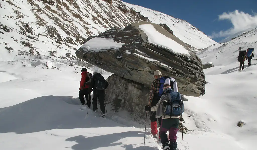
You’ll reach Italian Basse Camp by mid to late afternoon. This base camp got its name after the first Italian expedition to Dhaulagiri in the 1960s. The camp is a flat gravel area with mountains surrounding it. You can see Dhaulagiri II, III, and IV with a glimpse of Dhaulagiri I’s summit from the camp. You are standing on 3,660m, where the air is significantly thinner. We’ll set up tents here for the night. Shortness of breath or having a mild headache is common in this high-altitude environment. You should always communicate with your guide about how you’re feeling.
Altitude change: (insert start altitude) → 3,660 m
Distance: ~ (insert distance) km
Trekking hours: ~ (insert hours)
Activity level: Challenging (rocky terrain, steady climb, high altitude)
Highlights: Crossing glacier moraines; close-up views of Dhaulagiri peaks II, III, IV; glimpse of Dhaulagiri I summit; first high-altitude camping experience.
Meals Breakfast, Lunch, Dinner
Difficulty
You’ll spend an extra day in the Italian Base Camp for acclimatization to help our bodies adjust to the thinning air. Acclimatization is essential after days of ascending. Hike to a nearby ridge for a better view of the Chhonbardan Glacier.
These short hikes help in acclimatization as they climb high and sleep low, reducing altitude sickness risks. Stay active today and drink plenty of water to stay hydrated. Today will aid recovery if anyone in the group feels unwell due to altitude. Enjoy the beautiful sunrise/sunset from this natural amphitheater and catch the gold and pink hues hitting the white peaks.
Altitude: 3,660 m
Distance: Optional short hike (~2–3 km)
Trekking hours: ~2–3 hours (optional walk)
Activity level: Easy to moderate (short acclimatization hike)
Highlights: Acclimatization to high altitude; views of Chhonbardan Glacier; chance to rest and recover; stunning sunrise and sunset photo opportunities.
Meals Breakfast, Lunch, Dinner
Difficulty
The trek intensifies even more today as you hike on the glacier itself. Pass through the narrow gorge carefully, as it is prone to occasional rockfalls. Your guide will schedule this section in the early morning, as the conditions are safest.
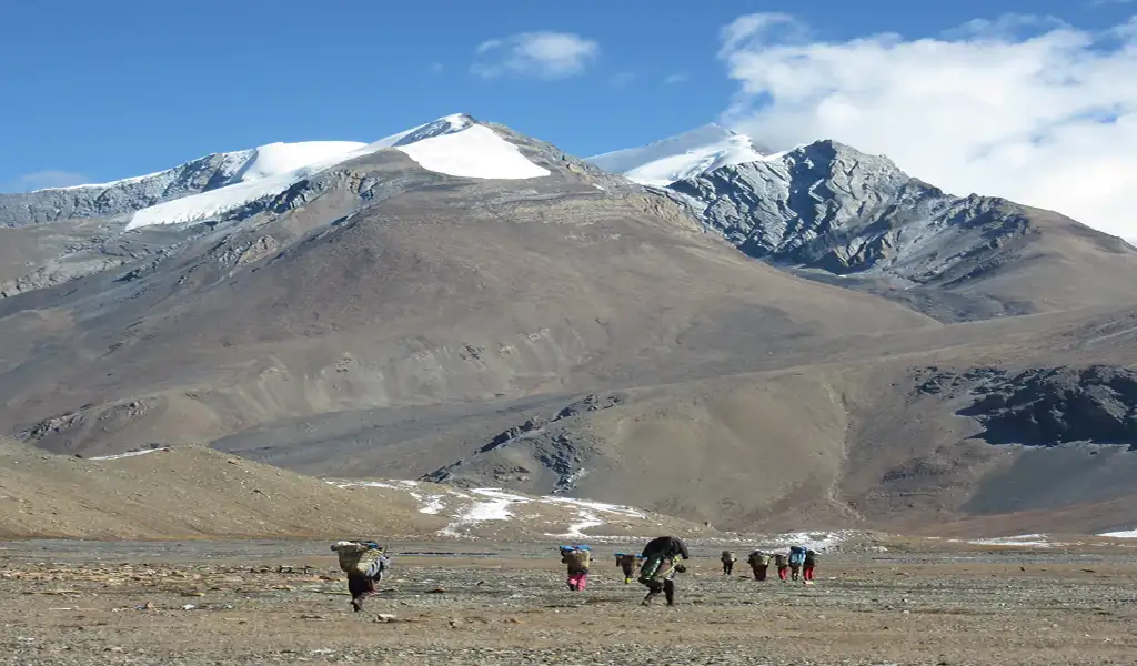
Cross the glacier and continue through the lateral moraine of the glacier. The scenery is fully alpine with just ice and giant mountains all around. You won’t find any plants here if you try to. Eventually, you’ll reach Glacier Camp around 4,210m after the challenging day. Glacier camp also has no permanent structures and introduces an actual wilderness camp on the ice.
The crew will set up some tents on the rocky moraine for the night. Night temperatures will drop below freezing, so sleep in warm layers and keep your water bottles inside the tent to prevent them from freezing. Since the place is completely remote with no light pollution, you can see the Milky Way in the night sky on clear days.
Altitude change: 3,660 m → 4,210 m
Distance: ~7 km (4.3 miles)
Trekking hours: ~5 hours
Activity level: Challenging (glacier travel, rocky moraine, high altitude)
Highlights: Crossing narrow rockfall-prone gorge; walking on glacier moraine; stark alpine environment; setting up camp on glacier edge; freezing nighttime temperatures; spectacular starry skies.
Meals Breakfast, Lunch, Dinner
Difficulty
Today is the trip’s highlight as you reach the base camp of Mount Dhaulagiri. Dhaulagiri is often called the White Mountain because of its dazzling white snow contrasting against the blue sky. You’ll trek through the glacier over ice and loose scree. Depending on the season and recent weather, snow may cover the trail near the base camp.
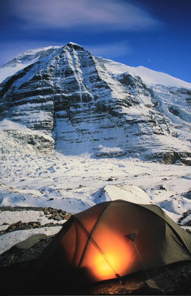
Move slowly and steadily at this altitude, as your body only gets half the oxygen at sea level. You will arrive at the base camp in the afternoon at the foot of the massive Dhaulagiri I. Climbing teams establish their camps here, so you may see prayer flags or old tent platforms. Peaks like Dhaulagiri I (8,167m), Dhaulagiri II (7,751m), and Dhaulagiri III (7,715m) to the west, and Dhaulagiri IV (7,618m) to the north. And the icefall of Upper Chhonbardan Glacier to the northeast surrounds the camp. You’ll camp on rocky, uneven ground in the designated trekking area. Layer up at night as temperatures drop to -10°C or lower.
Altitude change: 4,210 m → 4,740 m
Distance: ~6 km (3.7 miles)
Trekking hours: ~4–5 hours
Activity level: Challenging (high altitude, glacier, and scree terrain)
Highlights: Walking along glacier and scree; possible snow-covered trail; slow, steady ascent; arrival at base camp under Dhaulagiri’s north face; views of surrounding peaks and icefalls; freezing nights.
Meals Breakfast, Lunch, Dinner
Difficulty
Today is the second acclimatization day at high altitude. Your body needs time to recover before continuing through the challenging high passes. Keep your activities light at the base camp. You can take a short walk near the base of the icefall or along the glacier’s edge. Remember, you should stay active, but don’t overexert yourself.
Stay hydrated and eat well, even if you lose your appetite. The guides will closely monitor the team for any Acute Mountain Sickness signs. Communicate with your guide if you’re feeling unwell. If you feel fine, you can click pictures and enjoy the surroundings. Night temperature will drop below freezing, so have warm drinks and hot meals before bed.
Altitude: 4,740 m
Distance: Optional short walks (~1–3 km)
Trekking hours: Light activity day (~1–2 hours walking)
Activity level: Easy (rest day with light movement)
Highlights: Rest and recovery; light walks near icefall and glacier edge; monitoring for altitude sickness; stunning mountain views; cold nights with hot meals and drinks
Meals Breakfast, Lunch, Dinner
Difficulty
Today is one of the toughest days on the trek. Begin your trek early to cross the 5,360m French Pass in the morning when the mountain weather is most stable. The climb begins steeply with occasional sections requiring crampons or micro spikes for better grip. Go at a steady pace since the high altitude makes the trail more difficult.
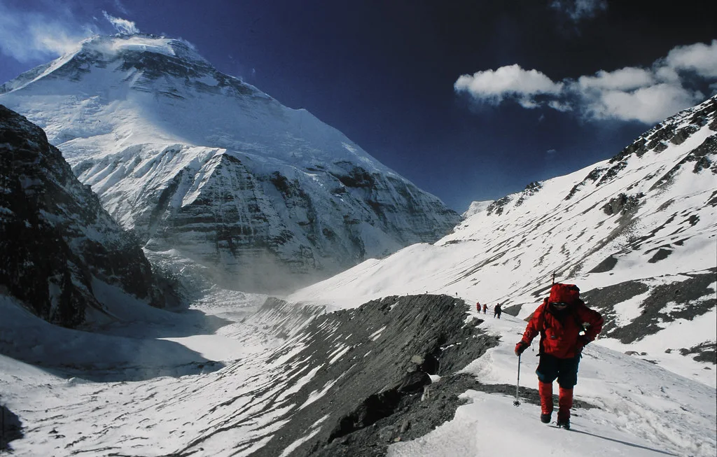
You will reach the top of French Pass after trekking through the rugged trail. Prayer flags from previous trekkers decorate the summit. You’ll get the panoramic views of the entire Dhaulagiri range from the French Pass, including the north face of Dhaulagiri I, and the Annapurna peaks in the south, with Hidden Valley in the east.
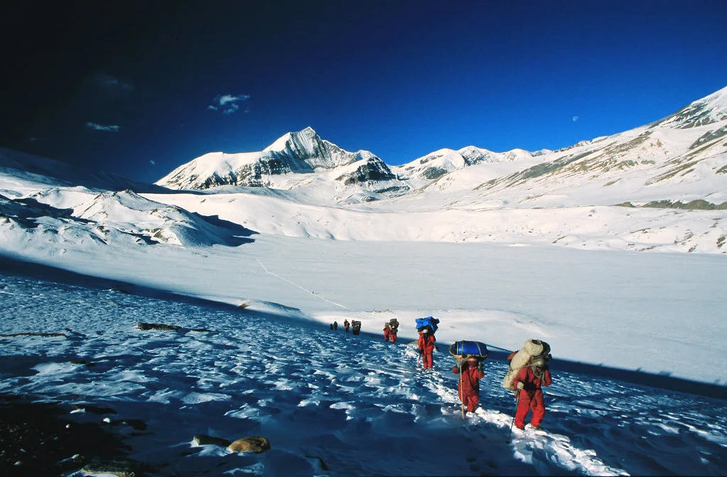
You might get glimpses of the mountains of Mustang across the valley. Take a brief rest and begin your descent through steep and snowy terrain. The first 200m down can be dangerous, so watch your footing. You will reach the Hidden Valley at 5,050m after descending. Hidden Valley stays true to its name as it is a remote, high-altitude valley covered in snow with a stark and quiet atmosphere. You’ll cross the valley floor and camp there for the night. There are no villages nearby, giving you the experience of wilderness.
Altitude change: 4,740 m → 5,360 m → 5,050 m
Distance: ~8 km (5 miles)
Trekking hours: ~7–8 hours
Activity level: Very challenging (steep glacier climb, high altitude, snow)
Highlights: Early start; crossing French Pass with panoramic mountain views; steep snowy descent; entering remote Hidden Valley; camping in isolated high-altitude wilderness
Meals Breakfast, Lunch, Dinner
Difficulty
Today’s high pass is slightly lower than yesterday’s. Have your breakfast in Dhampus and begin trekking towards Thapa Pass. While the climb is less steep than French Pass, it starts from above 5,000m, so you should move slowly. Dhampus Pass is around 5,200m and rewards you with more breathtaking views. The pass separated the Hidden Valley from the Kali Gandaki Valley.
You can see the Tukuche Peak and the Annapurna range to your south and the upper Mustang to your north. Take a short break in this pass and begin your descent to Yak Kharka. The trail is steep with scree, making it dusty or snowy depending on the season.
The descent may be tricky on your knees, but as you quickly lose elevation, the air gets thicker, making it easier for your lungs. Back on the trail, you will start noticing plants, from shrubs to grasses and rhododendrons. You will reach Yak Kharka (3,680 m) by mid or late afternoon. Translating to yak pasture in Nepali, many herders use this grassy meadow in the summer. You will stay in a small stone hut or lodge overnight. You are below 4,000m, so you can feel a burst of energy. Enjoy your rest and sleep early.
Altitude change: 5,050 m → 5,200 m → 3,680 m
Distance: ~12 km (7.5 miles)
Trekking hours: ~7 hours
Activity level: Challenging (high pass climb and long steep descent)
Highlights: Climb to Dhampus (Thapa) Pass; panoramic views of Annapurna and Mustang regions; long scree descent; returning vegetation; arrival at yak pasture campsite in Yak Kharka; relief at lower altitude.
Meals Breakfast, Lunch, Dinner
Difficulty
The trail leads you back into the green landscapes today. After descending for several hours from Yak Kharka, you reach the valley floor and join the Annapurna Circuit trail near the Marpha village. Your views for today will be shepherd herds and locals going about their day. Marpha is one of the most charming villages in the region.
It is famous for its apple orchards and apple-based products like juice, brandy, and pies. You can try some of the products if the shops are open. Explore the stone streets lined with whitewashed houses and prayer wheels in Marpha. You’ll probably take a local jeep or a bus for a 30-minute drive to Jomsom in Marpha.
Alternatively, you can hike 2 hours from Marpha to Jomsom if you prefer walking. The administrative hub of the Mustang district, Jomsom, has a small airport, making it the end of the trek. Jomsom is dry and has desert-like surroundings with strong afternoon winds. Settle into your lodge here and celebrate the completion of your Dhaulagiri Circuit Trek.
Altitude change: 3,680 m → 2,720 m
Distance: ~15 km (9.3 miles) including jeep/bus or 17 km walking
Trekking hours: ~8 hours walking (if on foot)
Activity level: Easy to moderate (mostly descending, some flat road)
Highlights: Return to villages and greenery; arrival at picturesque Marpha village; apple orchards and local products; short jeep/bus ride or flat walk to Jomsom; end of trek; desert-like landscape and strong winds; lodge stay and celebrations.
Meals Breakfast, Lunch, Dinner
Difficulty
Wake up early for your flight from Jomsom to Pokhara. We schedule meaning flights as strong winds develop later in the day. The short flight of 20 minutes offers some great views of the surrounding peaks. You’ll see Nilgiri and Dhaulagiri peaks, with the deep Kali Gandaki Gorge below. You will fly between Annapurna I and Dhaulagiri I, creating the illusion of touching them.
The air feels warmer and more humid in Pokhara. We drive you to your hotel, where you are typically free to do anything. Many trekkers have brunch by the lake at the cafes or take a boat ride on Phewa Lake. Pokhara has many good restaurants and shops, offering a great view of the Annapurna range even from a low elevation. It is the perfect spot to reflect on your trek and rest. Today also acts as a buffer day in case of weather delays or canceled flights from Jomsom.
Altitude change: 2,720 m → 820 m
Flight time: ~20 minutes
Activity level: Easy (short flight and rest day)
Highlights: Scenic flight with mountain and gorge views; arrival in Pokhara’s warmer, lush environment; free day to relax and explore; backup day for possible flight delays
Accommodation:
Kuti Resort or similar
Meals Breakfast
Difficulty
Transportation Flight
After breakfast, hop on the private vehicle for a ride back to Kathmandu. The drive follows Prithvi Highway along the Marsyangdi and Trishuli rivers. You’ll see lush green hills, small towns, and terraced farms from your drive and arrive in the busy city of Kathmandu by late afternoon. We will arrange a farewell dinner at a traditional Nepali restaurant in the evening. Enjoy authentic Nepali dishes like dal bhat, momo, and Newari specialties with cultural music and dance performances.
Distance: ~200 km (124 miles)
Travel time: about 6–7 hours
Activity level: Easy (scenic drive and rest)
Highlights: Scenic drive along the Marsyangdi and Trishuli rivers; views of Nepal’s countryside; arrival in Kathmandu; farewell dinner with traditional food and cultural performances
Accommodation:
Hotel Thamel Park or similar
Meals Breakfast
Difficulty
Transportation Tourist Bus
We arrange your drive to the airport for your flight back home if you’re leaving today. If you have additional plants, we will arrange your schedule accordingly. If not, you can pack your bags and go last-minute souvenir shopping or simply rest till your pickup. We ensure you reach the airport at least 3 hours before your departure so you have enough time to complete all flight formalities. We hope to see you again for more adventures in Nepal.
Meals Breakfast
Difficulty
The package price covers essential services, logistics, accommodation, and staffing for the duration of the 20-day trip:
1. Accommodation & Meals:
2. Staffing & Crew:
3. Permits & Fees:
4. Transportation & Flights:
5. Other Services:
The following personal, optional, and emergency expenses are not covered in the package price:
1. International Travel:
2. Insurance & Emergency:
3. Meals & Drinks:
4. Personal Expenses & Tips:
This trek is for trekkers with previous experience, like in the Annapurna Circuit or the Everest Base Camp. It is not an ideal option for the first trek. You should be fit enough to hike for about 7 hours with a loaded backpack for several days. The trek involves some steep climbs and tricky descents through rough terrain. You need good stamina and strong legs. Training in advance is necessary for a fit enough body.
The trek is also mentally demanding as you go through long days, cold nights, and live in simple conditions. You need to accept discomforts like no shower, sleeping in tents, and no internet. Keep a positive attitude and accept these challenges. Some nights you will sleep in tents instead of teahouses. Our team will try to make camping comfortable with a warm meal and shelter, but it’s still basic.
The Dhaulagiri Circuit trek is remote and off-the-beaten-path. You will enjoy the trek if you love nature, solitude, and unpredictability. You’ll trek in a group unless you book a private trek. The entire group needs to be supportive and flexible. You’ll share meals, camps, and sometimes tents. The trek will be challenging if you cannot adjust to a group setting.
The trek takes about three weeks, including travel time. You must dedicate your time fully and disconnect from work and other duties. If you identify with most of these points, Dhaulagiri is an excellent match for you. However challenging, this trek is deeply rewarding and has fantastic views.
You will stay in lodges, tents, and hotels throughout your trek. The facilities and charges depend on the altitude and place.
Teahouses (Mountain Lodges): Accommodation is mainly traditional Nepali teahouses in the lower and middle sections of the trek. These family-run lodges are simple with basic rooms. You will usually stay in rooms with two single beds, foam mattresses, and pillows. Most teahouses have a communal dining hall with a central stove of wood or dung and lights in the evening, providing warmth to the trekkers. You will likely share toilets with other trekkers and the lodge staff. Toilets are usually squat-style with limited washing facilities. Lower altitude lodges may offer hot showers for a small fee, but as you go higher, amenities start to reduce. Lodges are sometimes just a single room in a simple hut as you trek to higher altitudes. The hospitality and warmth of the owners make the humble teahouses feel like home.
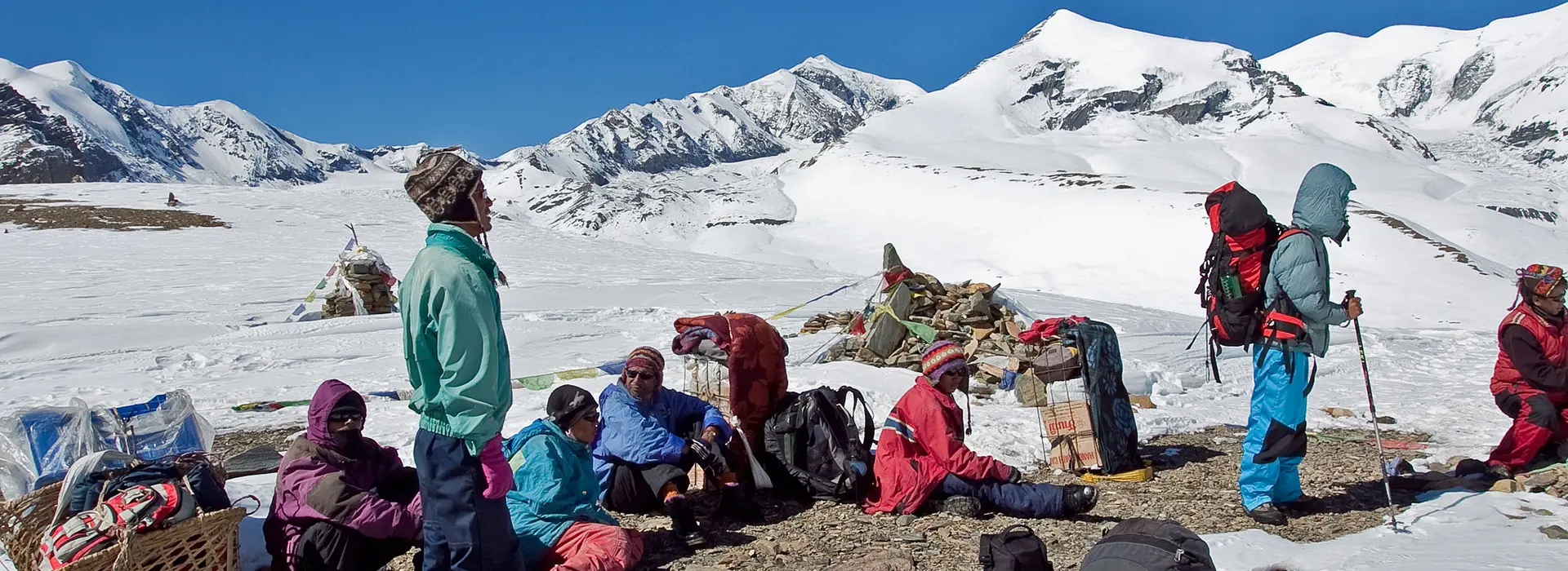
Camping (Tented Camps): There are no teahouses beyond Italian Base Camp, so you will camp in locations like Glacier Camp, Dhaulagiri Base Camp, Hidden Valley, etc. Our crew will provide all camping gear, including high-quality expedition tents for harsh conditions. Tents are usually twin-share unless you specifically ask for a single tent. We provide a foam mattress for comfort under your sleeping bag. You should bring a warm sleeping bag rated at least -20 °C or rent one from us in Kathmandu. Our cooks freshly prepare the meals, and we set up a dining tent for shelter during meals. Toilet tents with pit latrines are far from the camp for privacy. Camping may be tough, but it is memorable. Our crew will try to keep the atmosphere cheerful and comfortable with hot drinks and water for washing.
Hotel in Cities: You will stay in comfortable 3-star hotels in Kathmandu and Pokhara with clean rooms, attached bathrooms, hot showers, WiFi, and restaurants. Accommodation is twin share by default or double for couples. We offer upgrades to 4-star or 5-star hotels on request. Many trekkers appreciate the comfort of the hotels in caves after days in rugged terrain.
You can expect occasional power outages while trekking. You don’t get any heating in your bedroom and will sleep in your sleeping bag. Electricity for charging devices and WiFi is available with an extra fee. Our team will handle all logistics for you.
We offer some add-ons if you want more adventure in Nepal. These add-ons are entirely optional and come with an extra charge. You can talk to us during booking to add add-ons or special activities to your itinerary. We’ll customize the trek according to your plans.
Everest Mountain Flight: You can take an hour-long flight from Kathmandu in the early hours of the morning to see Everest. This flight offers beautiful aerial views of Mount Everest and the surrounding Himalayan peaks. You can enjoy Everest without actually trekking there.
Everest Base Camp Helicopter Tour: If you want a more thrilling adventure, you can take a helicopter ride from Kathmandu or Pokhara to the Everest region. The helicopter even lands at Kala Patthar or Everest Base Camp briefly so you can soak in the views from the land. In this half-day tour. You will see the giant Everest, Nuptse, Lhotse, and the Khumbu Glacier.
Hotel Upgrades in Kathmandu and Pokhara: We can arrange upgrades to a luxury four or 5-star hotel in Kathmandu and Pokhara if you want more comfort before and/or after your trek. You can enjoy amenities like a spa, swimming pools, and fine dining.
How to Book: You can book your trek easily with us. Visit our website and search for the Dhaulagiri Circuit Trek and book the trek. Select your preferred trekking date from our calendar and enter the number of travelers. Fill in the personal details form, including your passport information, and select your payment method. You must pay at least a 20% deposit to secure your booking. You can also pay the full amount upfront or pay the remaining at least 30 days before the trek. After booking the trek with us, you’ll get a confirmation email and receipt. We use a secure online system, making it easy for trekkers to book any trek they like. Contact us through WhatsApp or email if you have questions or want our assistance.
Payment Terms: You must pay a 20% deposit to proceed with the booking. The deposit secures your trekking permits, domestic flights, and other arrangements. You can pay the remaining balance about 30 days before the trek. If you book the trek within 30 days of departure, we require a full payment up front. We will send payment reminders occasionally. You can pay the balance through PayPal, credit cards, and bank transfers. We record all payments with transparency. We’ll send a detailed trip confirmation and preparation pack after we receive your booking confirmation.
Cancellation Policy: We make our cancellation policy as fair as possible. We have a grace period of 7 days, where if you book the trek 30 days before the departure date and wish to cancel it, we will offer a full refund. Remember, it’s a 7-day period only if you book the trek more than 30 days before the departure.
We will refund any amount paid beyond the deposit if you cancel up to 30 days before the trek starts. Cancelling any less than 30 days before the departure means no refunds, as it is challenging to fill your spot. We pre-pay for your trek logistics, so we can’t refund the amount within 30 days of the booking. Remember, the deposit is non-refundable in any case.
We will offer a full refund if we cancel the trek due to unforeseen circumstances. We recommend buying travel insurance that covers trip cancellation or interruption so you can receive support through your insurance. Our refunds will proceed within 15 business days to your original payment method.
Spring (March to May): Spring brings mild and stable weather with daytime temperatures of 25-20°C at lower elevations and colder conditions in higher elevations at around -10°C in the Base Camp at night. March and April bring beautiful, blooming rhododendrons covering the forests in red, pink, and white. Mornings have clear skies with clouds forming or light showers by afternoon. Temperature rises and humidity increase by late May, with the monsoon approaching. Spring offers excellent visibility with comfortable trekking conditions and beautiful scenery.
Autumn (September to November): Experts consider autumn the best trekking season for Nepal. This post-monsoon season brings clear blue skies with great views of the mountains. Temperature is moderate at 15°C or higher at mid altitudes, with colder nights in late autumn. Base Camp might get -10°C nights by November. Autumn doesn’t usually see rain, and the weather is generally stable. Many Nepali festivals fall in autumn, making the season festive and lively. Even though autumn is the prime trekking season, the Dhaulagiri circuit route remains quiet. It is the most reliable season for clear views and sad trekking trails.
Winter (December to February): We don’t recommend winter trekking for the Dhaulagiri Circuit for most trekkers. High altitudes can drop to -25°C or even colder with heavy snow blocking the trails. Lower sessions up to the Italian Base Camp are possible in winter only by experienced trekkers with the right gear. Crossing the French Pass during deep winter is almost impossible and extremely risky. It requires expedition-level preparation and is usually off-limits for most people. Days are short and trails can be icy with limited evacuation options.
Monsoon (June to August): It is best to avoid the monsoon. Heavy rain makes the trails in lower elevations muddy and leech-infested. Landslides are common, and mountain views are usually nonexistent, with the clouds blocking them. Flights from Jomsom usually get delayed or canceled due to rain. If summer is your only option, you can try trekking in Nepal’s rain shadow regions like Upper Dolpo or Mustang.
Shoulder Seasons: Late February to early March and late November to early December are the shoulder seasons. Late February to early March is cold, with snow at higher elevations, longer days, and daily weather improvement. Late November to early December has clear skies but colder temperatures with possible early winter snow. Shoulder seasons bring fewer trekkers but more weather risks.
You should attempt the Dhaulagiri Circuit trek ideally in spring or autumn. These seasons offer the best weather with good visibility and manageable conditions.
The Dhaulagiri Circuit Trek is one of the most challenging trekking routes in Nepal. While it doesn’t require technical climbing with ropes or mountaineering skills, it’s still a demanding high-altitude trek.
High Altitude: You’ll spend many days above 3,000m and multiple nights above 4,000m and 5,000m. You also cross the two high passes over 5,000m, including French Pass, where oxygen levels are half of those at sea level. The thin air makes each step harder. Our itinerary includes rest days and allows proper acclimatization to help your body adjust and reduce the risk of altitude sickness.
Long, Tough Day: Most days, you’ll be 6 to 7 hours on the trail with high-pass days lasting more than 8 hours. While the distance may not seem huge, the altitude and terrain make every day demanding. Elevation changes are dramatic and harsh on the knees and lungs. We start early on days like French Pass so we can keep a slow and steady pace.
Remote and rough terrain: You’ll trek on steep village trails in the first week of your trek. The trail then transforms to glaciers, moraines, snowfields, and occasional log bridge river crossings in the second week. You must climb over big rocks and through ice patches near the passes. No villages between Boghara and Marpha exist, so you need to camp with no quick way to leave.
Extreme Weather: Weather changes quickly at high altitude. You can expect intense UV sun and freezing nights with possible snowfall even in spring and autumn. Hidden Valley commonly gets high winds. Bring warm layers, a good down jacket, sturdy boots, and other essential gear.
Stamina and Strength: You need a good fitness level with strong legs and good endurance to finish this trek successfully. The trek is demanding and tests your lungs and legs. Try this circuit if you can comfortably hike for about 7 hours with a backpack in hilly terrain. You need trekking poles and knee support for long descents.
While challenging, the Dhaulagiri Circuit Trek is still possible for many. Hundreds of trekkers finish this trek each year with careful pacing, gradual acclimatization, and a determined mindset. It’s not ideal for first-time trekkers, so only well-prepared trekkers should try the Dhaulagiri Circuit.
Guide: An experienced, government-licensed guide will lead you throughout your trek. They are fluent in English and well-versed in Dhaulagiri’s trails, culture, nature, and weather. They handle safety, navigation, pacing, routes, and logistics like meals, teahouse coordination, and camp setup. They have first-aid and AMS response training, carry a first aid kit, and monitor their health at altitude. In an emergency, they arrange your evacuation and ensure everyone in the team is safe. They share their local knowledge and point out the peaks for you. Guides truly make your trek safer, more engaging, and fun.
Porters: Porters carry your gear, food, and personal duffels, allowing you to trek with just a daypack. Usually, one porter carries about 20-25 kg in total. Two trekkers share one porter, so each can pack about 10-12 kilograms for the porter. We ensure our porters get fair wages, an ethical workload, have proper equipment for the trek, and travel insurance under TAAN guidelines. Many of our porters are the regional locals and know the route like the back of their hands. We prioritize the welfare of our porters with weight limits, good food, and shelter. You can build a connection with your porter by sharing conversations and positive interactions.
Assistant Guides: If the group is more than eight trekkers, we assign an assistant guide so the group has enough support. The assistant guide will help monitor the team, manage the pace, and provide additional first-aid support. They will also lead the second group; in any case, the team has to split.
Your guide and porter team will handle all logistics and heavy lifting to allow you to focus on your trek. They enhance your experience through cultural exchange and care, making the trek possible in Dhaulagiri’s remote terrain. Keep the attitude respectful and friendly for a more rewarding and memorable trip.
The Dhaulagiri Circuit Trek is physically and mentally demanding. You cannot finish the trek successfully unless you are moderately fit. You should be able to hike up to 7 hours for several days through varied terrains.
Physical Training: Do cardio exercises like hiking, jogging, cycling, swimming, or stair climbing. Begin training at least three months in advance and aim for 30 to 45-minute sessions 3 or 4 times weekly. Go on longer hikes on weekends with a backpack when possible. You should do strength training for your legs and core to make climbing and carrying your daypack easier. Do exercises like squats, lunges, step-ups, calf raises, and planks. If you can, climb stairs or hills with a weighted pack to simulate the trail conditions. Practice hiking with your full gear and a loaded backpack of about 5 to 6 kg so you get used to the weight. It also helps you check your gears and break in your boots.
Altitude Training: Unless you live in the mountains or have exceptional facilities, altitude training is impossible. You can hike higher to increase lung capacity and help with altitude. Altitude sickness can attack anyone, so trek slowly and follow acclimatization days for a safe trek.
Mental Preparation: You must be determined to finish the trek successfully. You’ll be away from the familiar comfort for weeks and face cold nights, simple food, and no showers. You must maintain a positive attitude and be patient to help you push through difficult moments. Set small goals while trekking to make the big climbs feel more manageable.
Trekking is not a race. Even if you’re the last one in your group, you should walk at your own speed. Your safety and well-being matter more than speed. Listen to your body and take breaks whenever necessary. Being fit means more energy, but you should always stay within your limits to conserve energy. You’ll enjoy the trek and handle challenges better by following these training and preparation tips.
Mountain weather doesn’t follow a set schedule. A clear morning can still bring heavy rain, snow, or tail damage. In these cases, your guide may delay or reroute for safety. You should follow their decisions.
We build rest days into the itinerary to help the body adjust to the altitude. However, it is essential to remember that everyone reacts differently to the altitude. The guide will delay the trek if anyone in the group needs extra days to acclimate. This itinerary follows an average pace, but sometimes a group moves more slowly. In these cases, your guide will adjust the plans, like ending a day’s trek earlier to avoid hiking in the dark. Serious illnesses or injury may require evacuation or a change of plan.
Private groups have more flexibility in adjusting the itinerary and adding extra rest days. These adjustments vary depending on safety and timing. Guides make final safety decisions. They might cancel the trek, turn back, or evacuate the group. Their knowledge and expertise allow them to make appropriate decisions for the group. Weather or other conditions may bring a change in plans. You should embrace flexibility and use extra days to rest or explore.
Always communicate with your guide freely about how you feel or if you want to adjust your pace. The team will support personal needs when possible.
The Dhaulagiri Circuit Trek requires you to sleep many nights above 4,000m, where altitude sickness is a common problem. We design our itinerary to let your body gradually adjust to the thinner air.
You’ll climb carefully and rest plenty before going higher. For example, we include a great day in Italian Base Camp at 3,660m before moving higher to 4,200m+. You also rest an extra day at the Dhaulagiri Base Camp at around 4,740m to help the body adapt. We don’t increase the sleeping elevation more than 500 m per day after crossing the 3,000m mark.
The itinerary includes two full rest days for acclimatization. You will go on short hikes during these days to help the body get used to a higher altitude. You should drink about 4 liters of water and other fluids daily to stay hydrated. The altitude drains your body, so hydration and nutrition are key for proper acclimatization. Avoid alcohol, smoking, and excessive caffeine as they cause dehydration and worsen AMS. Walk at a slow pace on uphill days to avoid overexertion.
Our guides will check for signs of AMS in the group with daily health checks and pulse oximeters. You should tell your guide how you feel. You can detect early symptoms like headaches, nausea, dizziness, or difficulty sleeping., We take immediate action in case of severe symptoms. Some trekkers take Diamox to prevent AMS. You should consult your doctor before the trek if you can take Diamox.
We follow the strategy of climbing high and sleeping low to help the body adjust. If you feel unwell, stop ascending. We climb slowly, rest when needed, and stay hydrated and well fed. You should communicate well with your guide to manage the altitude and enjoy the trek.
While limited, you can charge your electronics while trekking. Lower villages like Muri or Dobang offer solar or hydropower charging with a small fee. Beyond the Italian Base Camp, electricity is not available. Bring a power bank to conserve device use. Our team will carry a small emergency solar charger, but fully charging is only possible upon returning to Jomsom or Pokhara.
The mobile signal is weak and unreliable, with limited coverage in lower altitudes and no phone network or WiFi beyond Muri. You will be offline for about 12 to 16 days until you reach Jomsom. Our team carries satellite phones or walkie-talkies for emergencies.
Lower-altitude teahouses occasionally offer hot showers with gas-heated water. Higher up, and while camping, a shower is not available. Our team will provide warm water and wet wipes for sponge baths. Toilets are basic, squat-style in separate outhouses. We set up a private toilet tent over pits while camping. It’s better to bring personal travel-size toilet paper, hand sanitizer, and wet wipes.
You get hearty meals in teahouses and freshly prepared meals while camping. We provide safe and treated drinking water and take care to minimize plastic waste. Hydration is key for acclimatization and energy.
Yes, you need travel insurance for the Dhaulagiri Circuit Trek. Your policy should include trekking up to 6,000m and helicopter evacuation. Travel insurance is essential for your safety, as medical emergencies can be costly and challenging.
Tipping is optional but an appropriate way to show appreciation for your guides and porters. Many trekkers tip their trekking crew about 10% of the cost. You can tip in Nepali rupees over the farewell dinner on the last evening.