


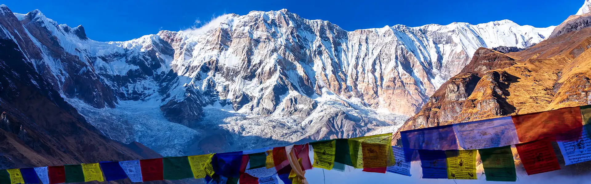

Quick Answer: How Do You Use This Thorong La Pass Guide?
Acclimatize in Manang for at least one full day. Walk gradually to Yak Kharka, then Thorong Phedi or High Camp. Start the crossing before sunrise. Move at a steady, slow pace. Carry warm layers, snacks, and water. Cross only in stable weather. Do not cross if you have altitude sickness symptoms, poor visibility, heavy snow, or strong wind.
| Topic | Details |
|---|---|
| Pass Name | Thorong La Pass |
| Altitude | 5,416 m |
| Trek Route | Annapurna Circuit |
| Connects | Manang side to Muktinath / Mustang side |
| Crossing Day | 7–10 hours depending on start point and conditions |
| Best Seasons | March–May and September–November |
| Difficulty | Challenging |
| Main Risks | Altitude, cold, wind, snow, low visibility |
| Permits Required | ACAP and TIMS / agency-issued trekker record; licensed guide mandatory |
Scroll to see the full table on small screens →
What Makes This Crossing Unique
Thorong La Pass stands at 5,416 meters. It is the highest point of the Annapurna Circuit and connects the Manang Valley with Muktinath on the western side. Every trekker who completes the circuit must cross it.
No technical climbing is required on the standard route. The difficulty comes from altitude, cold, wind, long hours on the trail, and the extended descent to Muktinath. A safe crossing depends on decisions made over several days — not just on the morning of the pass.
This Thorong La Pass guide covers the full route from Manang to Muktinath, with practical sections on acclimatization, packing, permits, altitude safety, weather, and the lessons from past incidents on the pass.
Why Thorong La Is the Key Challenge on the Annapurna Circuit
Thorong La is not the longest day of the Annapurna Circuit, but it is the most demanding. Thin air above 5,000 meters slows every step. The crossing begins before sunrise in cold, dark conditions. Wind at the pass can cut through layers fast. The descent to Muktinath is long and hard on the knees.
Weather changes quickly at this altitude. A clear morning can turn into snowfall within hours. The 2014 Annapurna snowstorm — which killed dozens of trekkers near Thorong La in October — is a clear reminder that the pass demands real respect, even in peak season.
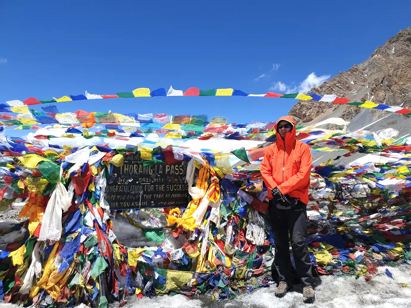
The reward is equally real. Reaching the prayer flags at 5,416 meters and looking out over two distinct mountain valleys is one of the most satisfying moments any Himalayan trekker experiences.
Quick Answer: How Do You Use This Thorong La Pass Guide? Acclimatize in Manang for at least one full day.…
 11 Days
 Moderate
Route Overview: Manang to Muktinath
The complete crossing section of this Thorong La Pass guide runs from Manang through Yak Kharka, Thorong Phedi, the pass, and down to Muktinath.
| Section | Approx. Altitude | Purpose |
|---|---|---|
| Manang | 3,540 m | Acclimatization base; HRA altitude talk available |
| Yak Kharka | 4,050 m | Gradual altitude gain |
| Ledar | 4,200 m | Optional overnight stop |
| Thorong Phedi | 4,450 m | Main pre-pass stop; lower and safer sleeping altitude |
| Thorong High Camp | 4,850 m | Higher pre-pass stop; shortens crossing day |
| Thorong La Pass | 5,416 m | The highest point of the Annapurna Circuit |
| Muktinath / Ranipauwa | ~3,760 m | Descent target; rest and recovery |
Scroll to see the full table on small screens →
Acclimatization Before Thorong La Pass
Do not treat Thorong La as a single hard day. A safe crossing starts several days earlier with good acclimatization in Manang. Sleeping altitude should not increase by more than 300 to 500 meters per day above 2,500 meters. A rest day after every 1,000 meters of altitude gain helps the body adjust.
| Day | Route | Sleep Altitude | Purpose |
|---|---|---|---|
| 1 | Manang rest and acclimatization day | 3,540 m | The body adjusts before gaining altitude |
| 2 | Manang to Yak Kharka | 4,050 m | Gradual altitude gain |
| 3 | Yak Kharka to Thorong Phedi | 4,450 m | Pre-pass overnight |
| 4 | Thorong Phedi / High Camp → Thorong La → Muktinath | 5,416 m (pass) | Main crossing day |
Scroll to see full table on small screens →
Good Acclimatization Hikes from Manang
Use your rest day in Manang for short altitude hikes. Walking higher and sleeping lower is the standard acclimatization strategy.
- Gangapurna Lake and viewpoint
- Praken Gompa / Lama viewpoint
- Bhojo Gompa area
- Ice Lake hike — best for fit trekkers who want more altitude exposure
Thorong Phedi vs. High Camp: Where Should You Sleep?
One of the most important decisions in this Thorong La Pass guide is where to sleep the night before the crossing. Both options have real trade-offs.
| Factor | Thorong Phedi (4,450 m) | Thorong High Camp (4,850 m) |
|---|---|---|
| Sleep quality | Usually better | Often harder at higher altitude |
| Pass day length | Longer crossing day | Shorter crossing day |
| AMS risk overnight | Lower | Higher |
| Best for | Most trekkers are cautious groups | Strong, well-acclimatized trekkers only |
| Main advantage | Safer sleeping altitude | Shorter ascent on crossing day |
| Main disadvantage | More ascent on crossing day | Higher overnight altitude stress |
Scroll to see the full table on small screens →
Stay at Thorong Phedi if you feel tired, have slept poorly, or have mild altitude symptoms. Use High Camp only if you feel strong, have no symptoms, and your guide agrees. Your guide’s judgment matters more than time-saving.
The Crossing Day: Hour-by-Hour Thorong La Pass Guide
The crossing day is long, cold, and physically demanding. Start early, pace carefully, and keep moving toward Muktinath once you begin the descent.
| Time | Action | Notes |
|---|---|---|
| 3:30–4:30 AM | Wake up | Check the weather, layers, headlamp, water, and snacks |
| 4:00–5:00 AM | Start walking | Earlier from Phedi; slightly later from High Camp |
| 6:00–7:00 AM | Upper climb | Steady pace; avoid sweating too much in the cold |
| 8:00–9:30 AM | Reach Thorong La Pass | Short break, photos, prayer flags — do not linger in strong wind |
| 9:30–10:00 AM | Start descent | Wind increases later in the morning — move promptly |
| 10:00 AM–1:00 PM | Descend toward Muktinath | Long downhill on loose trail; use trekking poles |
| 1:00–3:00 PM | Arrive in Muktinath | Rest, hydrate, eat properly |
Scroll to see the full table on small screens →
Wear all your layers from the start. Carry snacks and water within easy reach. Limit time at the pass if the wind picks up. Descend immediately if symptoms worsen.
Difficulty Rating
| Factor | Level | Note |
|---|---|---|
| Technical climbing | Low | No ropes needed on the standard route |
| Altitude | High | Pass reaches 5,416 m |
| Walking duration | High | 7–10 hours on the crossing day |
| Cold exposure | High | Pre-dawn start and wind at the pass |
| Descent | High | Long, loose downhill to Muktinath |
| Beginner suitability | Possible with preparation | Requires guide, pre-trek training, and full acclimatization |
Scroll to see the full table on small screens →
Altitude Sickness on Thorong La Pass
Altitude sickness affects trekkers at any fitness level. Every Thorong La Pass guide must address it clearly because the consequences of ignoring symptoms at 5,400 meters are serious.
Warning Signs to Know
- A headache that does not go away with water and rest
- Nausea or loss of appetite
- Dizziness or lightheadedness
- Unusual fatigue or weakness
- Poor sleep at altitude
- Shortness of breath while resting
- Confusion or poor coordination — treat these as serious emergencies
Altitude Safety Rules
- Never hide symptoms from your guide
- Do not climb higher if symptoms worsen
- Do not sleep at High Camp with active symptoms
- Do not cross the pass if you feel clearly unwell
- Descend immediately if symptoms become moderate or severe
Warning: Do not cross Thorong La Pass with worsening altitude sickness symptoms, heavy fatigue, whiteout conditions, strong wind, or heavy snow. Turning back is always safer than pushing through dangerous conditions.
Best Time to Use This Thorong La Pass Guide
| Season | Months | Crossing Outlook | Main Risk |
|---|---|---|---|
| Autumn | Sep–Nov | Best overall conditions | Crowds; cold November nights |
| Spring | Mar–May | Good in stable weather windows | Snow and wind on the pass |
| Winter | Dec–Feb | Risky — experts only | Snow, ice, extreme cold, pass closure |
| Monsoon | Jun–Aug | Not recommended | Rain, landslides, low visibility |
Scroll to see the full table on small screens →
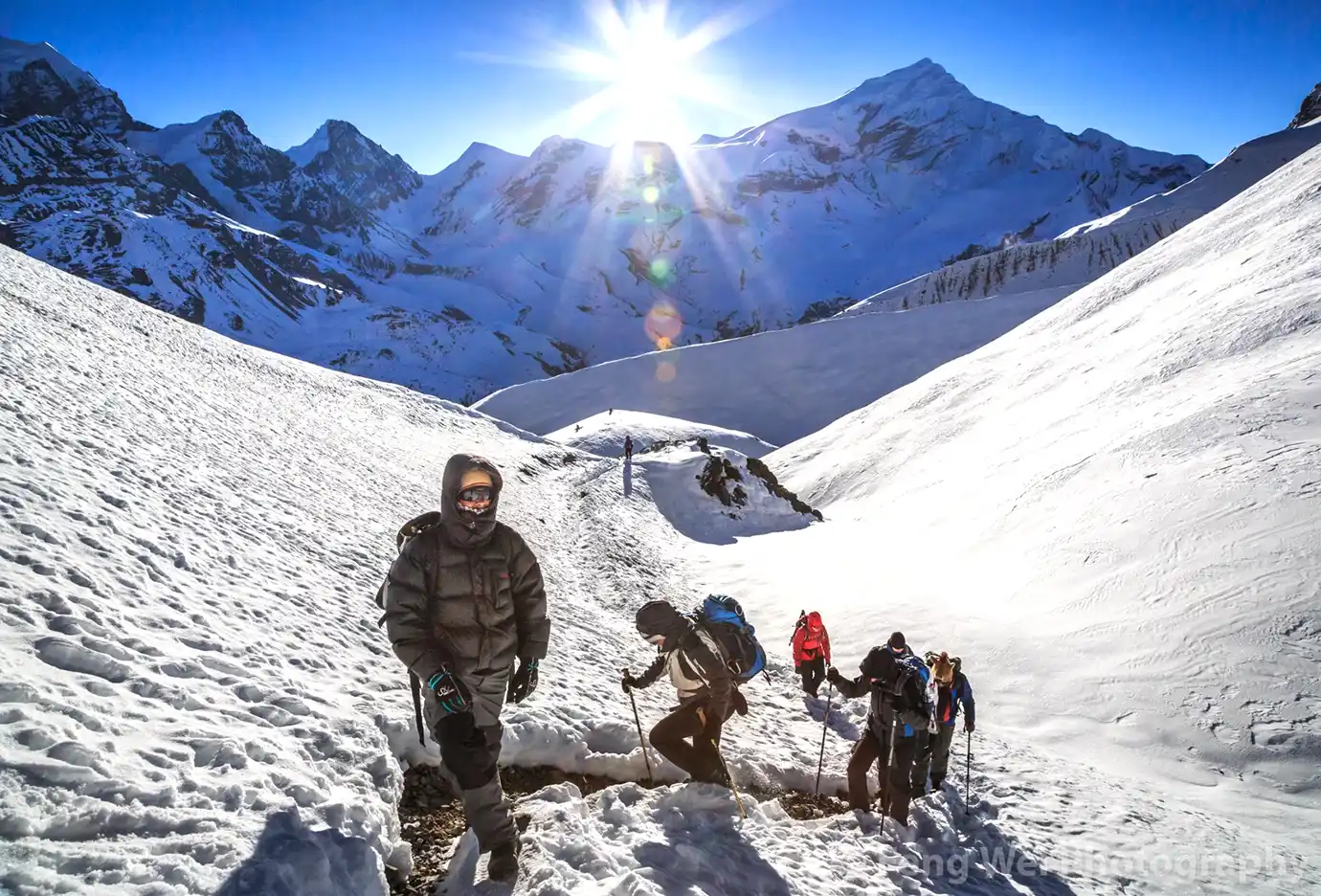
October and November offer the clearest conditions and are the best months to cross Thorong La Pass. April and May also work well, though snow may still cover the upper sections in early spring. Winter crossings require extreme experience, warm gear, and very careful weather judgment.
Packing List for the Crossing Day
Pack for darkness, cold, wind, and long hours. Keep gloves, a hat, a headlamp, snacks, and water within easy reach throughout the day.
Clothing
- Thermal base layer — top and bottom
- Fleece mid-layer
- Down jacket
- Windproof and waterproof shell
- Trekking pants
- Warm hat, buff, liner gloves, and insulated gloves
- Warm socks — at least one spare pair
Gear and Safety
- Broken-in, waterproof trekking boots
- Trekking poles
- Headlamp with fresh batteries
- Sunglasses and sunscreen
- Microspikes if snow or ice is expected on the trail
- Insulated water bottle — prevents freezing in sub-zero temperatures
- Energy bars, trail mix, chocolate, dried fruit, electrolytes
- Lip balm and personal medications
- Emergency blanket in your daypack
Food, Water, and Energy on Crossing Day
Eat a light breakfast before departure. Carry fast-energy snacks that fit in your jacket pocket: nuts, energy bars, chocolate, biscuits, and electrolyte drinks.
Drink regularly, even when you do not feel thirsty. Cold conditions suppress thirst, but dehydration worsens altitude sickness. Use insulated bottles if temperatures drop below freezing. Avoid long stops in cold wind. Eat a proper warm meal as soon as you reach Muktinath.
Permits and Guide Rules
| Permit / Rule | Required? | Notes |
|---|---|---|
| ACAP Entry Permit | Yes | NPR 3,000 for foreigners; NPR 1,000 for SAARC nationals |
| TIMS / agency trekker record | Yes | Annapurna Circuit is included under the revised NTB TIMS provision |
| Licensed trekking guide | Yes | Mandatory under the NTB revised TIMS provision |
| Restricted Area Permit | No (standard circuit) | Required only if adding Nar Phu or Upper Mustang extensions |
Scroll to see full table on small screens →
Safety Lessons from the 2014 Annapurna Snowstorm
A major snowstorm struck the Annapurna region in October 2014, killing dozens of trekkers on and near Thorong La Pass. Every Thorong La Pass guide should address this event directly because it changed how safety is managed on the circuit.
The key lessons from 2014:
- Never ignore a bad weather forecast — even in October
- Do not cross in whiteout conditions
- Turn back early if visibility drops sharply
- Carry full warm layers even in peak season
- Start early to reduce afternoon weather exposure
- Use a licensed guide who checks current trail conditions each morning
- Buy trekking insurance that covers high-altitude helicopter rescue
- Do not rely on helicopter rescue in bad weather — flights cannot operate in snowstorms
After the Pass: Muktinath and Beyond
After crossing Thorong La, most trekkers spend the night in Muktinath or Ranipauwa. The Muktinath Temple complex — sacred to both Hindus and Buddhists — adds significant cultural value to the descent day.
Many trekkers continue west through Kagbeni, Jomsom, Marpha, and Tatopani. Jomsom has a small airport with flights to Pokhara, but weather conditions often affect them. The Mustang-side landscape shifts to a drier, more arid terrain — visually quite different from the lush Manang valley on the eastern side. Kagbeni, the Kali Gandaki gorge, and Marpha’s apple orchards reward trekkers who extend beyond Muktinath.
Common Mistakes and How to Avoid Them
| Mistake | Fix |
|---|---|
| Skipping the Manang acclimatization day | Add one full rest and acclimatization day in Manang |
| Sleeping at High Camp with altitude symptoms | Stay at Thorong Phedi or descend |
| Starting the crossing too late | Start before sunrise, ideally between 3:30 and 5:00 AM |
| Moving too fast on the ascent | Maintain a slow, steady pace throughout |
| Wearing light gloves | Carry insulated gloves — wind makes thin gloves useless above 5,000 m |
| Not carrying snacks | Pack quick-energy food accessible throughout the day |
| Staying too long at the pass in wind | Take photos quickly and start the descent |
| Underestimating the descent | Use trekking poles; protect knees on the long downhill to Muktinath |
| Crossing in poor visibility | Wait for conditions to clear or turn back — do not push through |
| No proper trekking insurance | Choose a policy that covers high-altitude trekking and helicopter evacuation |
Scroll to see full table on small screens →
Thorong La vs. Other High Passes in Nepal
| Pass | Altitude | Trek Route | Difficulty | Main Challenge |
|---|---|---|---|---|
| Thorong La | 5,416 m | Annapurna Circuit | Challenging | Long crossing and altitude |
| Cho La | 5,420 m | Everest Gokyo–EBC | Challenging | Glacier and rocky terrain |
| Renjo La | 5,360 m | Everest Three Passes | Challenging | Long high-altitude day |
| Kongma La | 5,535 m | Everest Three Passes | Very challenging | Remote route and altitude |
| Larkya La | 5,106 m | Manaslu Circuit | Challenging | Long remote crossing |
Scroll to see full table on small screens →
Frequently Asked Questions
How high is Thorong La Pass?
Thorong La Pass stands at 5,416 meters. It is the highest point on the Annapurna Circuit and connects the Manang Valley with Muktinath on the western side. Proper preparation is essential at this altitude.
How long does the crossing take?
Most trekkers take 7 to 10 hours for the full crossing. Total time depends on your start point — Thorong Phedi or High Camp — plus weather, snow conditions, and personal pace.
Is Thorong La Pass difficult?
Yes. The crossing is challenging due to high altitude, extreme cold, strong wind, a very early start, and a long, steep descent to Muktinath. It is the hardest day on the Annapurna Circuit.
Does the crossing require technical climbing?
No. The standard route does not require ropes or technical climbing skills. Snow and ice can change conditions significantly, however, and the altitude demands respect regardless of the absence of technical terrain.
Where should I sleep the night before — Thorong Phedi or High Camp?
Thorong Phedi is the better choice for most trekkers. The lower sleeping altitude reduces altitude stress. Stay at High Camp only if you feel strong, have no symptoms, and your guide agrees.
What time should I start?
Start between 3:30 and 5:00 AM. An early start helps you avoid stronger afternoon winds, reduces weather risk, and gives you enough daylight to reach Muktinath safely.
Can beginners cross Thorong La Pass?
Fit beginners can complete the crossing with proper training, a licensed guide, full acclimatization, and a stable weather window. Those new to high-altitude trekking should prepare seriously before attempting the Annapurna Circuit.
When is the best month to cross Thorong La Pass?
October and November offer the best overall conditions. April and May also work well, though early spring can bring snow on the upper sections. These four months give the best balance of visibility, stability, and safety for the crossing.
What permits do I need?
An ACAP permit and a TIMS card or agency-issued trekker documentation are required. A licensed guide is mandatory under the revised NTB TIMS provision. The standard Annapurna Circuit does not require a restricted area permit unless you add Nar Phu or Upper Mustang.
Do I need a guide?
Yes. A licensed guide and agency-issued TIMS documentation are mandatory under current NTB rules. A guide also provides critical support for altitude management, route decisions, and emergency coordination.
What should I pack for crossing day?
Pack thermal layers, a down jacket, a windproof shell, insulated gloves, a warm hat, trekking poles, a headlamp, sunglasses, sunscreen, snacks, and an insulated water bottle. Carry microspikes if snow or ice is expected.
What happens after crossing Thorong La?
After crossing, trekkers descend to Muktinath or Ranipauwa for the night. Many continue to Kagbeni, Jomsom, Marpha, and Tatopani. Jomsom has flights to Pokhara, though weather affects them regularly.
Can I cross in winter?
Winter crossings are only possible under very specific conditions and carry a serious risk. Extreme cold, heavy snow, possible lodge closures, and potential pass closures make crossings from December to February suitable only for highly experienced and well-equipped trekkers.
Final Advice: Use This Thorong La Pass Guide to Prepare Well
Thorong La Pass defines the Annapurna Circuit. A successful crossing rewards well-prepared trekkers with one of the most memorable experiences in the Himalayas.
Follow this Thorong La Pass guide from the beginning: acclimatize properly in Manang, walk gradually to Yak Kharka and Thorong Phedi, choose your sleep location wisely, start before sunrise, pace steadily, and descend to Muktinath without rushing at the top.
Choose the right season. Train for long walks, both uphill and downhill, before you arrive. Confirm all permits and your guide arrangement before the trek starts. Pack warm layers and carry insurance that covers high-altitude helicopter evacuation.
Listen to your guide. Start early. Walk slowly. Turn back if the weather changes or altitude symptoms worsen. The pass will be there on another clear morning — no single crossing day is worth a serious risk to your safety.