
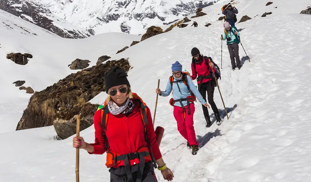
The Annapurna Circuit is famous for a reason. Your trek begins in lush forests and rice terraces, then gradually transitions to high-altitude deserts with giant mountains. You’ll notice a mix of culture, landscape, and villages throughout the trek.
There is no official route or fixed duration for the trek in the Annapurna Circuit. It can take you anywhere between 10 and more than 20 days, depending on your starting/ending points and what side trips you include. The local authorities have built many new roads in the area, which can shorten some sections.
Standard Annapurna Circuit Trek Itinerary
Here is a detailed itinerary for a typical Annapurna Circuit trek following the counter-clockwise route from the Marsyangdi River valley to the Kali Gandaki valley. This plan assumes overland travel from Kathmandu to the trailhead and finishing near Pokhara.
Day 1: Kathmandu to Jagat (1,300 m / 4,265 ft) – 8-to-9-hour drive
Your trek begins as you take a jeep from Kathmandu to Jagat. You can drive through the hills to Besisahar at 760m by bus or jeep, then continue to Jaga on a rough road by jeep. Most trekkers begin their trek at Jagat to avoid the newer road sections. You’ll stay in a basic teahouse as the Marsyangdi River flows in the valley below.
Day 2: Jagat to Dharapani (1,960 m / 6,430 ft) – 6 to 7 hours trekking
The trails go through lush sub-tropical forests and river crossings. You’ll be on foot and pass villages like Chamje and Tal. Tal is a beautiful village with a waterfall that marks the beginning of the Manang district. You’ll climb steadily to Dharapani, where two rivers meet, with a checkpoint to register permits.
Day 3: Dharapani to Chame (2,670 m / 8,760 ft) – 5 to 6 hours trekking
The path continues through pine and fir forests. You’ll also get your first views of the significant peaks like Langtang Himal to the east and Annapurna II to the west. Chame is Manang’s district headquarters and offers basic facilities like shops, a bank, and a small hot spring nearby. Evenings are also noticeably colder here.
Day 4: Chame to Pisang (3,200 m / 10,500 ft) – around 5 hours trekking
Leave Chame and continue on the trail through a steep, narrow gorge decorated with prayer flags. You’ll walk by Paungda Danda, a high, curved cliff above the river. As you gain altitude, you’ll notice the vegetation thinning out. Lower Pisang sits in a broad valley, while Upper Pisang sits on a hill with a monastery. The views are incredible, along with the surrounding peaks today.
Day 5: Pisang to Manang (3,540 m / 11,614 ft) – 5 to 7 hours trekking
You can choose between the lower, easier route through Humde or the higher route through Ghyaru and Ngawal. While tougher, the higher route offers excellent views of Annapurna II, III, IV, and Gangapurna. You’ll reach Manang by afternoon. Manang is a lively village with bakeries, shops, and even a small movie hall.
Day 6: Manang (3,540 m) – Acclimatization Day
Most itineraries include a resting day in Manang to let your body adjust to the high altitude. You can go on a side hike to Gangapurna Lake at 3,900m or a hill overlooking the Annapurna massif to stimulate the body by increasing red blood pressure. These hikes help the body adapt and offer excellent photography settings. You can explore Braga Monastery or enjoy a local apple pie in the evening.
Day 7: Manang to Yak Kharka (4,050 m / 13,287 ft) – 4 to 5 hours trekking
The scenery is stark beyond Manang. You will exit the tree line and scrubby bushes, and alpine grass starts dominating the surroundings. The trail climbs past Gunsang to Yak Kharka, a small pasture where herders bring their livestock in the summer. Look out for blue sheep on the cliffs. Since you are at a high altitude, you should take it slow and hydrate well.
Day 8: Yak Kharka to Thorong Phedi (4,450 m / 14,600 ft) – 3 to 4 hours trekking
Today is a shorter day for extra acclimatization before the pass. The trail descends to cross a river at around 4,200m, then climbs steadily to Thorong Phedi, a small cluster of lodges on the mountainside. Fit trekkers continue to High Camp at 4,800 to shorten the next day’s climb. You can go on a short acclimatization hike or read in the afternoon to prepare for tomorrow’s hike.
Day 9: Thorong Phedi to Muktinath (3,800 m / 12,467 ft) via Thorong La Pass (5,416 m / 17,769 ft) – 7 to 9 hours trekking
The most challenging day begins early at pre-dawn with an ascent to Thorong La Pass. The climb is steep and requires effort on each step. However tough, the summit of the Thorong La rewards you with 360-degree views of the Annapurna range peaks stretching into Tibet—Prater flags and a signboard mark the summit of the pass. Then, you’ll descend steeply to Muktinath and drop about 1,600m in altitude in a vertical cliff. Muktinath is a sacred site with temples, prayer wheels, and an eternal flame. It is an essential site for both Hindus and Buddhists. You can enjoy a hot meal and rest in the evening.
Day 10: Muktinath to Jomsom (2,720 m / 8,923 ft) – 5 to 7 hours trekking or jeep
The trail now enters Mustang, a dry desert-like region. Today, you trek mostly downhill or flat. Before descending into the Kali Gandaki River valley, you’ll pass the Jharkot village and its red gompa. Afternoon picks up harsh wind, making the trail dusty. Many trekkers take a jeep from Muktinath to Jomsom to save time and knees. Jomsom has an airport and offers many modern amenities.
Day 11: Jomsom to Pokhara (820 m / 2,690 ft) – end of trek
Most trekkers fly from Jomsom to Pokhara in the morning. The flight offers excellent views of the Annapurna. If your flight gets canceled, you’ll take a jeep or bus through the Kali Gandaki valley to Tatopani and Pokhara. Pokhara is at a lower altitude and has a mild climate. You can treat yourself to a meal or a massage to celebrate finishing the trek.
Note: You can adjust this itinerary based on your fitness and interests. The key is to allow enough time for acclimatization and enjoy the trek’s highlights.
Annapurna Circuit Trek Itinerary Variations and Side Trips
One of the best things about the Annapurna Circuit is its flexibility. Trekkers can adjust the route to match their time, fitness, and interests.
Shorter Itineraries Using Vehicles: Since the building of newer roads, you can shorten some parts. If you’re short on time, you can begin your trek a little higher via jeep. Instead of starting the trek at Jagat, you can drive to Chame and start trekking there. It cuts down the first 2 to 3 days of walking. When ending your trek, you can stop at Jomsom and take a flight to Pokhara to skip the descent to Tatopani and Ghorepani. Combining both options, you can reduce trekking by 8 to 10 days. Remember that skipping the lower sections means you miss some scenery, and your body has less time to acclimate naturally.
Tilicho Lake Side Trip: Tilicho Lake is one of the most popular off-route trips on the Annapurna Circuit. It usually adds about 2 to 3 days to your trek. You’ll hike to Tilicho Base Camp, then up to Tilicho Lake at about 4,930m from Manang. You can then return to the main trail at Yak Kharka or back at Manang. This lake is the highest in the world and is deep blue, surrounded by towering mountains. The hike is challenging with steep sections and occasional landslide risks, but the scenery makes the effort worthwhile.
Ghorepani and Poon Hill Extension: Some trekkers continue the trek to Ghorepani and Poon Hill after descending to Tatopani. Poon Hill at 3,210m is a famous viewpoint for the Annapurna and Dhaulagiri ranges during sunrise. You hike up through mid-hill forests to Ghorepani for two days from Tatopani, then climb to poon Hill the next morning. After Poo Hill, you’ll descend to Nayapul and drive back to Pokhara. It adds up to 3 or 4 days in your itinerary and offers a beautiful view of the Annapurna range.
Annapurna Base Camp Link-Up: Trekkers with extra days and strong fitness can combine the Annapurna Circuit with the Annapurna Sanctuary Trek. One option is to finish the circuit in Pokhara, then trek from Nayapul to ABC at 4,130m, adding about 8 days. Another option is to branch off the circuit near Tatopani or Ghorepani and reach the Sanctuary through Ghandruk. A full link-up can take over three weeks as you circle the entire Annapurna Massif. With this link-up, you’ll get to the foot of Annapurna I at Base Camp.
Each option has its pros and cons. Side trips let you see more but require extra time and energy, while vehicles save time but reduce natural acclimatization and the sense of continuous trekking. When planning, think about your interests, time, and fitness. You can stick to your main trail or mix in variations. Either way, the Annapurna Circuit is an unforgettable experience.
Practical Tips for Planning Your Itinerary
Permits: You need the Annapurna Conservation Area Permit (ACAP) for the Annapurna Circuit Trek. You can get it in Kathmandu, Pokhara, or the trail entry checkpoint in Besisahar. As of 2025, you no longer need the TIMS card in the Annapurna region, but rules may change, so check for the latest information.
Best Time to Trek: The best season is undoubtedly spring and autumn. March to May and late September to November have mostly stable weather and clear skies. Temperatures stay mild during the day but remain cold at high altitudes. Trails and villages are fully open, and mountain views are extremely clear. Monsoons from June to September bring heavy rain, slippery trails, and landslide risks. December to February welcome Winter and stay cold with snow blocking the Thorong La Pass. Some trekkers trek the circuit off-season with pepper preparation, but most stick to spring or autumn.
Trekking Direction – Go Counter-Clockwise: Plan to do the circuit counter-clockwise, starting on the Marsyangdi side and ending on the Kali Gandaki side. It is not just tradition; it is safer. The counter-clockwise route allows you to gain altitude gradually. Doing the trek clockwise would mean a steep climb to Thorong La from the west side without enough time to acclimatize. Most trekkers and guided groups follow the counter-clockwise route for safety.
Guide or Porter: Hiring a guide is not up for debate. You must have a licensed guide accompanying you to get permits for the Annapurna Circuit. A guide can enhance your experience by handling logistics, leading the route, and providing local insights. You can also hire porters if you want help carrying your pack.
Accommodation and Food: You’ll stay in lodges throughout the trek while on the Annapurna Circuit. Meals usually include dal bhat, fried rice, noodles, potatoes, and Western dishes like pasta or pancakes. Try to reach your day’s destination by mid-afternoon. Lodges can fill up in peak season. If you arrive late, you may even have to sleep in the dining halls or on the floor.
Pace and Rest: Do not rush the trek. You should add a buffer day for your safety. If you feel tired, you can skip the day. You can enjoy the trek best when you have the energy to appreciate the views and local culture. Listen to your body and adjust your schedule as needed.
Conclusion
The Annapurna Circuit trek is not the same for everyone. Some people stick to the classic route and finish in about two weeks. Others add side trips and stretch it into a longer adventure. Planning helps you get the best out of your time in the Himalayas. The goal is to enjoy each step, from the villages at the start to crossing Thorong La and reaching Mustang. When you know your options and plan smartly, you can confidently take on the Annapurna Circuit and bring home memories that stay with you forever.