
When people think of the Annapurna Circuit, they usually think of the 200km long distance. While it is true that if you follow the classic loop, the present version is shorter. With new roads, people can take a shorter route to minimize the 200km Annapurna Circuit Trek Distance. Your trekking distance still depends on what route you take. If you choose the traditional trail, it’s close to 200km, and if you follow the changed itinerary, you’ll cover less. We’ll compare the old route and today’s version with a day-by-day breakdown, and explain what affects your trekking distance.
The Historical Distance: The Classic 200 km Loop
When people say that the Annapurna Circuit is 200km, they mean the old classic route before roads reached the region. The trek began in Besisahar in the Marsyangdi River Valley in the early days. Trekkers would step off the bus from Kathmandu or Pokhara and immediately start walking from there, with no vehicle options up the valley.
The loop would end at Nayapul, close to Pokhara. Most trekkers would descend through the Kali Gandaki River Valley or include an additional section through Ghorepani and Poon Hill. Poon Hill is famous for the Annapurna and Dhaulagiri views during the sunrise. Trekkers would then take a short drive to Pokhara from Nayapul to complete the trek.
The full loop circles the Annapurna Massif using the old network of foot trails. You’d gradually climb the Marsyangdi Valley on the eastern side and cross the trek’s high point at Thorong La Pass at 5,416m. If you add the Ghorepani-Poon Hill detour, the trek would extend slightly.
Completing this entire loop takes about 18 to 21 days and covers about 200-230km, depending on the route variations and side trips. Since trails were not always officially measured and varied from village to village, slight differences in the total distances were common.
The classic Annapurna Circuit was a continuous trek from Besisahar, completing a full loop around the Annapurna range entirely on foot, with no motor transport along the route.
The Modern Distance: How Roads Changed Everything
People often describe the Annapurna Circuit as a 200-kilometer trek, and that number matched reality for many years. Trekkers walked the whole loop from Besisahar to Nayapul, covering nearly 200 kilometers, or about 124 miles. Today, road construction in the Marsyangdi and Kali Gandaki valleys changes how most trekkers experience this route.
Roads on the East (Marsyangdi side): A rough road now runs from Besisahar up the Marsyangdi Valley and reaches many villages along the way. You can jeep to Chame, the district headquarters, and sometimes Manang. But the path to Chame is risky and frequently blocked. Many trekkers take a vehicle to Jagat or Dharapani and skip the first 2-3 days of trekking. Some even drive to Chame and cut roughly a week off the trek.
Roads on the West (Kali Gandaki side): The road runs from Pokhara or Beni up the Kali Gandaki Valley towards Muktinath on the west side. You can take a jeep or bus to Jomsom and even Muktinath. After crossing Thorong La Pass, you can leave the trail quickly instead of hiking from Muktinath to Tatopani and Nayapul for several days. Many end their trek at Jomsom or even at Muktinath, then fly or drive to save a significant portion of walking.
How the Roads Change Trekking Distances: Instead of trekking from Besisahar through Ngadi, Jagat, and Tal, you can start trekking from Jagat or even at Dharapani or Chame. It cuts about 40 to 60km of walking. Trekkers also finish the trek at Jomsom instead of trekking to Pokhara now. It cuts about 70 to 80 km of walking on the west side of the circuit.
Typical Modern Distances: Most trekkers walk around 110-120 km if they start from Jagat and end at Jomsom. Starting from Chame and ending at Jomsom, you’ll walk as little as 80 km. You can still take the 200km route if you want the traditional route from Besisahar to Nayapul. This route now serves mainly as a guideline instead of a typical itinerary.
Day-by-Day Annapurna Circuit Trek Distance Breakdown
Day 1: Jagat (1,300 m) to Dharapani (1,960 m) – Distance: ~15 km
Follow the Marsyangdi River, passing waterfalls and crossing bridges. Trek through villages like Chame and Tal, which sit beside a broad river valley. You gain about 600 m of elevation over a 6–7-hour hike.
Day 2: Dharapani to Chame (2,710 m) – Distance: ~16 km
You’ll trek through pine and oak forests and stop at villages like Timang, offering great views of Manaslu and Koto. You’ll reach Manang’s administrative center, Chame, covering a distance of 16 km in about 5 to 6 hours.
Day 3: Chame to Pisang (3,300 m) – Distance: ~14 km
Today, you’ll trek through steep valleys with towering peaks. One section features a path cut into a rock face with a new walkway. You’ll pass the Paungda Danda rock face and arrive at Lower Pisang (3,200m). You can continue to Upper Pisang (3,300m) for the night for better views. Today, you’ll cover about 14km in about 5 hours if you rest in Lower Pisang. If you want to continue to Upper Pisang, you will walk for about 6 hours.
Day 4: Pisang to Manang (3,540 m) – Distance: ~17 km via upper route (Ghyaru and Ngawal) or ~15 km via lower route
You can choose the upper route through Ghyaru (3,670m) and Ngawal (3,660m) if you want steep climbs with panoramic views of Annapurna II, III, IV, and the valley. This route will take you about 7 hours on the trail. Alternatively, you can also take the lower route through Humde and Braga, which is easier and takes only about 5 to 6 hours.
Day 5: Manang (Acclimatization Day) – Distance: minimal, ~3–5 km side hikes
Today is your acclimatizing day, so you’ll rest. You can take side hikes to Gangapurna or nearby viewpoints and villages like Khangsar. The focus is on adjusting to the altitude while staying active.
Day 6: Manang to Yak Kharka (4,050 m) – Distance: ~9 km
The trail climbs steadily through Tenki and leaves the Marsyangdi Valley. You’ll notice a transforming landscape with scrubby grass and junipers in the alpine territory. You can spot blue sheep and grazing yaks. Today is just a 3 to 4-hour trek along 9 km to aid acclimatization.
Day 7: Yak Kharka to Thorong Phedi (4,525 m) – Distance: ~6 km
Today’s trek is short, but you can feel the altitude. Descend briefly to cross a river, then climb to Thorong Phedi. Optionally, if you have acclimatized to the altitude, you can push to High Camp, which is 1.5 km extra, +300 m elevation.
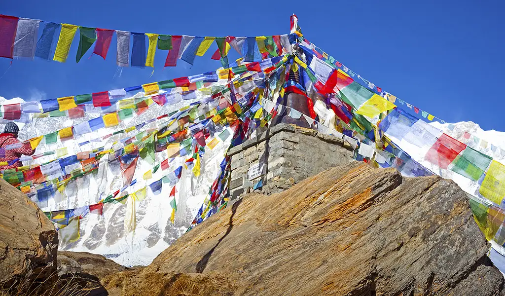
Day 8: Thorong Phedi to Thorong La Pass (5,416 m) to Muktinath (3,800 m) – Distance: ~16 km
Your trek will start pre-dawn to climb to Thorong La Pass (5 km ascent). Celebrate at the top, then descend ~11 km over a 1,600 m vertical drop to Muktinath. Muktinath is a sacred site with temples, shrines, and roads for vehicles. You’ll trek for about 7–9 hours and cover about 16 km.
Day 9: Muktinath to Jomsom (2,720 m) – Distance: ~20 km if walking fully
Today’s trek covers about 20 km as you enter the Mustang region. Start by walking to Kagbeni at the junction of the Jhong and Kali Gandaki rivers, then continue down the Kali Gandaki riverbed to Jomsom. The terrain is dry and desert-like, and strong winds usually pick up in the afternoon. You can take a jeep from Muktinath or Ranipauwa, but walking the whole distance takes 6–7 hours. Jomsom has an airport, banks, and shops, marking the usual end of the trek.
Starting from Besisahar adds ~27 km. Completing the full classic circuit to Nayapul via Poon Hill adds ~90 km, totaling ~230 km. Modern itineraries usually cover 110–120 km, depending on where you start and finish. This particular itinerary, starting from Jagat to Jomsom, covers about 113 km.
Factors That Influence Your Trekking Distance
Every trekker walks a slightly different Annapurna Circuit Trek Distance, and that’s part of the adventure. Side trips make a big difference: Tilicho Lake adds 30–40 km over a few days, Ice Lake near Manang is about a 10 km day hike, and if you detour to Poon Hill, that’s another 30–40 km over a couple of days. Even small choices matter. Taking the upper or lower route from Pisang to Manang significantly changes the distance, and exploring Upper Pisang or Ngawal can sneak in a few extra kilometers.
Where you start and finish has the most significant impact. Start at Chame instead of Jagat, and you skip the first chunk of the trek, walking only around 60 km to Jomsom. Finish at Muktinath instead of Jomsom, and you shave off another 20 km. How you trek also changes things: if you wander around villages, check out that far-off monastery, or take little side loops, you’ll add a few kilometers without even realizing it.
Even your choice of lodges can add some walking. Some teahouses sit off the main trail, and picking Upper Pisang over Lower Pisang adds a bit of uphill detour. And don’t forget Mother Nature – landslides or trail changes can force longer detours or a stretch on the road.
The distance on a map never quite matches what you walk. All the twists, turns, and little detours add up, so your total kilometers might surprise you. That’s just part of the Annapurna Circuit experience.
Conclusion
Is the Annapurna Circuit 200 km? If you hike the original circuit from Besisahar to Pokhara, it is roughly 200 km, or up to 230 km with side trips. Most trekkers today take vehicles on some road sections and focus on the highlights. That usually means the Annapurna Circuit Trek Distance is 110–160 km, depending on where you start and finish. Whether you walk 100 km or 200 km, the Annapurna Circuit is a challenging and unforgettable adventure.