
The Annapurna Base Camp trek is one of the most popular and challenging treks in Nepal. Your trek depends on your itinerary and starting point. You can typically complete this route between 7 and 12 days. The standard, most popular route is approximately 110 kilometers (68 miles) round trip. You need to trek approximately 55 km to reach base camp, then retrace or take a slightly different path to return the same distance.
The diverse terrain and significant elevation changes make the ABC trek a challenging experience. You’ll ascend from about 800 m (Pokhara) to over 4,100 m (ABC), and descend all that again. The trail takes you up and down thousands of stone steps, cross suspension bridges, traverse rice terraces, and hike through deep gorges. Steepness, altitude, and trail conditions make a kilometer in the Himalayas feel longer. To know exactly what to expect, you should understand the daily breakdown, altitude profile, and trail type.
In this article, we break down the Annapurna Base Camp trek distance by day to help you understand what to expect on the trail in terms of daily mileage and trekking hours. We’ll also discuss why focusing only on distance can be misleading when planning for this trek. By the end, it will be clear that the key to tackling the Annapurna Base Camp trek isn’t racing through kilometers – pacing yourself, acclimatizing properly, and enjoying the spectacular views.
A Day-by-Day Breakdown of the Distance
Day 1: Pokhara to Nayapul (drive), Trek to Tikhedhunga/Ulleri
Distance: ~9–10 km trekking (plus ~40 km drive)
Time: 1.5-hour drive, then 4–6 hours walking
You typically begin with a gentle warm-up. From Pokhara (~820 m), you drive to Nayapul (1,070 m), the trailhead. The drive cuts off some distance (if you walked from Pokhara, it’d add many kilometers of roads). At Nayapul, you begin walking along a relatively gentle path by the Modi Khola River. The trek to Tikhedhunga (1,540 m) starts on a dirt road, followed by a footpath through villages and farmland – a pleasant introduction. Most of this first 5–6 km is a gradual incline with a few up-and-down sections.
After Tikhedhunga, the real test comes: the Ulleri staircase. Over 3,000 stone steps wind up to Ulleri (2,050 m). Those steps pack a lot of elevation gain into a short distance (only about 3 km from Tikhedhunga to Ulleri, but a climb of about 500 m vertically). Many trekkers recall this section vividly because it’s one of the toughest bits of “trail” early on. At Ulleri, you stop for the night. By the end of Day 1, you’ve covered roughly 10 km on foot.
It’s a relatively short distance, but factoring in that massive staircase, your legs will feel it. You’ve also gone from the trailhead at 1,070 m to about 2,050 m – a significant height gain you’ll want to do slowly.
Day 2: Ulleri to Ghorepani
Distance: ~8–11 km
Time: 5–7 hours
Today’s distance might sound modest, but the trail continues upward (though not as steep as the Ulleri steps). You trek through a beautiful rhododendron and oak forest, gradually gaining altitude. Villages like Banthanti and Nangethanti break up the journey – they’re great spots for tea and rest.
The trail has segments of stone steps and gentle slopes. You aim to reach Ghorepani (2,860 m) by this afternoon. It is a climb of about 800 m from Ulleri, spread out over ~10 km, so it’s much more gradual than the previous day’s big staircase. As you near Ghorepani, the forest opens up occasionally to give you tantalizing glimpses of the mountains (especially if the weather is clear).
Reaching Ghorepani, you’ve done roughly 18–20 km on the trek. Distance-wise, it’s not huge, but remember – you’ve been mainly going uphill since the start. Ghorepani is a larger trekking hub where routes converge. Trekkers often sleep early here because the Poon Hill sunrise is on the agenda for the next day.
Day 3: Poon Hill in the morning, then Ghorepani to Tadapani/Chhomrong
Distance: ~9–12 km (plus ~2 km up and down Poon Hill)
Time: 6–8 hours (including Poon Hill excursion)
Day 3 involves an extra distance for those who opt for the Poon Hill side trip. Before dawn, you hike about 1 km up (and 1 km down) for the sunrise view. It’s a steep 1 km, with an elevation gain of about 350 m, to reach Poon Hill (3,210 m) over that distance. The round trip might add 2 km and ~1.5–2 hours to your day, but it’s optional and worth it for most. After returning to Ghorepani and having breakfast, you set off towards Tadapani (2,630 m) or possibly Chhomrong (2,170 m), depending on your chosen itinerary.
If you go to Tadapani, the trail first climbs slightly from Ghorepani to Deurali Pass (~3,100 m), then it’s mostly downhill and rolling terrain through the forest. From the high point of the morning, you descend approximately 600 m to Banthanti and then ascend slightly to Tadapani. The distance from Ghorepani to Tadapani is roughly 9 km. It’s a gorgeous walk – parts of it feel almost prehistoric, with mossy trees and occasional sightings of monkeys or deer.
Suppose your itinerary instead pushes on to Chhomrong in one day (some ambitious schedules do this by skipping Tadapani). In that case, it’s a much longer day: approximately 12 km from Ghorepani to Chhomrong, which involves a descent to Kimrong Khola and then a significant ascent to Chhomrong. Most people break it into two days (Ghorepani to Tadapani, then Tadapani to Chhomrong the next day) because of the substantial ups and downs.
By the end of Day 3, if you stopped at Tadapani, you’ve trekked roughly 25–30 km in total since Nayapul. Crucially, you’ve also experienced a significant elevation change, going from 2,860 m (Ghorepani) to 3,210 m (Poon Hill) and then down to 2,630 m (Tadapani) – this fluctuation is excellent for acclimatization.
Day 4 & 5: Tadapani/Chhomrong to Machhapuchhre Base Camp (MBC)
Distance: ~18–20 km over two days
Time: 6–8 hours each day
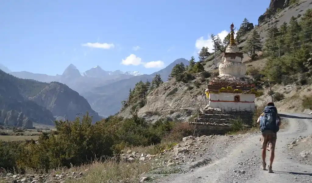
These two days carry you deep into the Annapurna Sanctuary. If you stayed in Tadapani on Day 3, then on Day 4, you’ll trek to Chhomrong, down and up to Sinuwa/Bamboo. Let’s say the distance from Tadapani to Chhomrong is about 6 km. You steeply descend to the Kimrong Khola (losing 500 m), then climb a long ridge to reach Chhomrong (2,170 m). After a lunch with a great mountain view in Chhomrong, you descend a set of steps to the river again (Chhomrong Khola) at about 1,900 m, then climb to Sinuwa (2,360 m).
On this night, many itineraries stop at Sinuwa or Bamboo (2,310 m). Tadapani to Sinuwa is approximately 10–11 km of trekking. It has a lot of vertical (down then up), which makes it feel longer. By now, you’ve gone maybe 35–40 km in total. On Day 5, from Sinuwa/Bamboo, you push on to Machhapuchhre Base Camp (3,700 m). It is where distance and altitude come into play. From Bamboo to MBC, the distance is approximately 10 km.
You pass Dovan (2,500 m), Himalaya Hotel (~2,900 m), and Deurali (3,200 m) on the way. Each of these segments is approximately 5 kilometers long, featuring moderate climbs. The valley narrows, and you follow the Modi Khola upstream. The trail is sometimes steep, sometimes gentle. When you reach MBC, the total one-way distance from the start is around 45–50 km. Some trekkers break this part differently (for example, stop at Deurali and make it a Day 6 to reach ABC).
But assuming a steady 5-day ascent, you cover a significant distance each day. The key here is that the kilometers might not sound high (10 km for the day), but you’ve gone from ~2,300 m to 3,700 m altitude in that distance. The thinner air often means you walk more slowly and take more breaks.
Day 6: MBC to Annapurna Base Camp (ABC)
Distance: ~3–4 km (one-way)
Time: 2–3 hours (up)
The final, most anticipated day is relatively short in distance. Machhapuchhre Base Camp to Annapurna Base Camp is only about 3.5 km further. However, at altitudes above 3,700 m, every step can feel like two. The trail from MBC to ABC is steady uphill but not as steep as in earlier parts – it follows a broad valley. You might start this day very early to catch the sunrise at ABC.
The hiking time is approximately 2 hours if you’re acclimatized and moving at a steady pace. You ascend those last 400 m of elevation over a few kilometers. Upon arriving at Annapurna Base Camp, you’ve reached the primary goal (4,130 m). If you add up the distances, by ABC, you have walked roughly fifty kilometers from Nayapul (not counting any driving). Despite being a short-distance day, you’ll feel it because of the altitude. Most trekkers spend a few hours or an overnight at ABC to rest and take it all in. From here on, it’s mostly retracing steps back down.
Return Journey (ABC back to Pokhara) – 3 to 4 days, ~45–50 km
Distance: ~45–50 km (over 3–4 days)
Time: 6–8 hours per day descending
The return trek often follows the same route until Chhomrong, then some itineraries diverge to include Jhinu or Ghandruk. In general, descending is faster – you can cover more distance going down than up in a day. A typical return itinerary might be:
Day 6 (or 7, depending on how you count):
ABC back down to Bamboo or Sinuwa (~15 km). A big descent, but as you drop altitude, you can breathe easier and move quicker.
Next day: Bamboo/Sinuwa to Jhinu Danda (1,780 m) (~10 km). It includes climbing the Chhomrong steps and then a long descent to Jhinu. By now, your legs might be jelly from all the downhill.
Final day: Jhinu to Siwai/Nayapul (~10–12 km) and then drive to Pokhara. If starting from Jhinu, you follow the Modi Khola through several villages. Some people cut the last few kilometers by taking a jeep from Siwai (sparing themselves 2–3 hours of walking on a rough road).
If you didn’t go to Jhinu, another option is to take the Chhomrong route to Ghandruk and Nayapul, which is scenic and avoids re-climbing to Ghorepani. Distances on exit vary with these choices but are in the same ballpark.
By the time you’re back on the road and drive to Pokhara, you will have trekked roughly 110 km. Those kilometers include countless stone steps up and down, dozens of bridge crossings, and an elevation change of over 4,000 m up and 4,000 m down. It’s an impressive feat when you think about it. Most trekkers take 3 days to descend from ABC, but some push in 2 long days (ABC to Chhomrong, then Chhomrong to Nayapul in one go – which is rough on the knees but feasible for very fit individuals or those short on time).
Why Distance Can Be Deceptive
If you only look at the 110 km Annapurna Base Camp trek distance, it’s not too daunting. After all, an average person can walk that far on flat terrain in a few days. But the trek’s difficulty is less about the number of kilometers and more about how those kilometers are traveled.
Firstly, the altitude gain and loss are huge. The route doesn’t go steadily uphill in a straight shot; it goes up, then down, then up again – repeatedly. For instance, in the middle of the trek, you descend a few hundred meters from Poon Hill down to Tadapani or Chhomrong, only to climb back up toward Deurali and ABC. These elevation changes mean your legs constantly work hard, either climbing or braking on descents.
The cumulative elevation gain over the trek is roughly equivalent to climbing from sea level to beyond 4,000 m multiple times! You ascend well over 6,000 meters across all the ups and downs. That’s why even a “short” day can feel exhausting. Walking 5 km on level ground might be a breeze, but climbing 5 km of steep steps and trails is another story. Your muscles and lungs are working much harder than the distance suggests.
Secondly, consider the terrain. Steep stone staircases (like the Ulleri steps and the long descent to Chhomrong). They are giant stairs carved into the hillside and can be relentless on your thighs going up and brutal on your knees coming down.
Rocky, uneven paths where you have to watch your footing. You’re often stepping on rocks of varying sizes, which slows you down compared to a smooth path.
Dirt and mud trails through forests, sometimes with exposed roots and slippery sections (especially if it rained recently or in the monsoon season). It requires careful treading, which again means a slower pace.
Narrow trails along terraced fields or cliff sides. In some places, you need to go single file and pay attention to avoid a misstep, which isn’t tricky but keeps you focused.
Suspension bridges swaying over rivers. They don’t add physical distance (they’re part of the trail), but if there’s traffic (like pack mules or other trekkers), you might have to wait or go slowly, making a 100m bridge feel like an event.
All these factors mean that a kilometer in this terrain takes more time and energy than a kilometer on a flat sidewalk. Trekkers often find their pace is maybe 2–4 km per hour, depending on whether it’s uphill or flat, whereas on a flat walk at home, 5 km per hour is easy for many. The constant change in elevation also means you rarely get a long, steady rhythm like you might on a flat hike. Instead, you might spend an hour going 500 m uphill, then half an hour going 500 m downhill, both of which use different muscles and challenge endurance.
Thirdly, there’s the altitude itself. The air has less oxygen as you gain height, especially above 3,000 m. It means you get tired more quickly. A 5 km walk at 4,000 m can feel as exhausting as a 15 km walk at sea level. Every uphill step near base camp can leave you breathing hard if you don’t acclimate properly. Even though the distance from Machhapuchhre Base Camp to Annapurna Base Camp is only 3–4 kilometers, it usually takes 2–3 hours because you must go slowly at high altitude.
Your body forces you to slow down, or you risk running out of breath or getting altitude sickness symptoms. Even on the way down, altitude can make you a bit clumsy or slower until you get below 2,500–3,000 m, where most people feel “normal” again.
In summary, the Annapurna Base Camp trek distance can be deceptive because distance alone isn’t a good measure of difficulty in the Himalayas. A relatively short-sounding hike can be exhausting if it’s incredibly steep and high. Conversely, a longer distance day might feel okay if it’s mostly flat or downhill and you’re well-rested. Consider the elevation profile when planning: daily ascent and descent, as well as maximum altitude, are just as crucial as the distance traveled.
For example, walking 10 km from Chhomrong to Deurali sounds fine until you realize it includes a 1,000 m altitude gain into thin air. Or descending 10 km from ABC to Bamboo might seem easy until you discover it involves 1,800 m of knee-pounding descent. So, remember the big picture: the Annapurna trek’s challenges come from a mix of steepness, altitude, and trail surface. The number of kilometers is just one part of the story.
Annapurna Base Camp vs. Everest Base Camp: A Distance Comparison
Total Distance
The standard ABC trek is roughly 110 km round trip (as discussed). The standard EBC trek is about 130 km round trip (Lukla to EBC and back to Lukla). So, in terms of distance, the Everest trek is approximately 20 km longer. That said, itineraries can vary. Some EBC itineraries may be slightly longer if they include detours to places like Ama Dablam Base Camp or Gokyo (a separate variation that adds a significant amount of distance). Still, the classic out-and-back via Tengboche and Gorak Shep is ~130 km.
Daily Distance and Duration
On the Annapurna Base Camp trek, daily distances vary: one day might be 10 km, another might be 4 km (e.g., MBC to ABC). There’s much variation in terrain each day (as described). On the Everest Base Camp trek starting from Lukla, typical days might cover 8–15 km. For example, Lukla to Namche Bazaar is ~13 km (with a significant climb at the end), and Namche Bazaar to Tengboche is around 10 km, etc.
One big difference is that the EBC trek usually includes dedicated acclimatization days (where you might hike a short distance higher and come back down). EBC trekkers typically spend a day in Namche (3,440 m) hiking a few kilometers to Everest View Hotel or Khumjung and back – that adds maybe 3–4 km “optional” distance. Another option is at Dingboche (4,360 m), where they might climb Nagarkar Hill (approximately a 5 km round trip). These aren’t forward progress along the route but add to the total walking distance and help with acclimatization.
Terrain Differences
The EBC trail is also up-and-down, especially in the first half (many river valley drops and climbs). The Annapurna region trail, as noted, has its share of steep segments. Some trekkers feel that the Annapurna Sanctuary trail has more frequent steep steps, whereas the Everest trail, although featuring big climbs, often zigzags up more gradually (except for Namche Hill). The footing on both treks is generally sound – well-maintained paths – but EBC has more length above the tree line, which means more gravel and rocky trails for longer stretches. ABC has a shorter section above the tree line.
Trekking Days
The ABC trek can be completed in as few as 6 days of walking (for very tight schedules), but more comfortably in 7–8 days up and 3–4 days down (total around 10–12 days, including a rest or buffer). The EBC trek from Lukla typically takes around 8 days to ascend and 3–4 days to descend (total 11–14 days, including acclimatization days). So, EBC is a longer-term commitment. Regarding daily distance, on ABC, you might have a couple of shorter days (e.g., Deurali to ABC is a short distance). In contrast, on EBC, the distances are a bit more evenly spread, but the high altitude slows you similarly in the latter part.
Perceived Effort
Many people who have done both treks comment that while the EBC trek covers a greater distance, both treks are challenging in their own ways. ABC’s intense stair climbs and the rapid gains and losses of elevation can be difficult, but you start at a lower altitude, and your sleeping altitudes are generally lower than on EBC. EBC’s longer distance and higher altitude (sleeping at 4,900 m in Gorak Shep, with an optional climb to 5,545 m at Kala Patthar) make it a more consistently strenuous high-altitude experience.
The takeaway
If you’re short on time or wary of extreme altitude, the ABC trek’s slightly shorter distance and lower elevation might make it a better option. If you’re up for a longer journey and want to experience the unique high-mountain scenery of the Everest region, then the extra distance and effort of the EBC could be worthwhile. Both treks are spectacular, and distance numbers aside, they offer different experiences – lush greenery and diverse scenery on ABC vs. the stark grandeur of Everest’s realm on EBC.
Practical Advice for a Successful Trek
Pacing: Emphasize a slow and steady pace. It is more crucial than quickly covering a certain number of kilometers daily. Listen to your body’s rhythm. On steep uphill, it often helps to take slow, deliberate steps (the famous “rest step”: pause a moment with each step) rather than rushing and stopping frequently. Going at a controlled pace on downhills will save your knees and reduce the chance of slips. Remember, it’s a trek, not a race. The key is consistent progress – even if it feels slow, you’ll reach your destination with more energy and fewer problems.
Break the Journey into Sections
Mentally breaking the trek into smaller goals can make the long distance less daunting. Focus on reaching the next village or resting spot, rather than worrying about how far you need to trek. Celebrate the milestones, such as reaching Ghorepani and arriving at ABC, to enjoy the trek fully.
Training and Fitness
Prepare for the trek by strengthening your endurance and leg strength. You can begin training a few months before the trek. Do some hill or stair training to simulate the ups and downs. Cardiovascular exercises, such as running, cycling, or swimming, can improve your stamina. Strong legs and core will help balance on uneven terrain while carrying a backpack.
The trek distance might not feel overwhelming when spread over many days if your body is well-conditioned. Also, practice walking with the gear you intend to carry. If you plan to wear sure boots or take a certain daypack, use them in your training walks to ensure they’re comfortable.
Choosing an Itinerary
Don’t squeeze the trek into fewer days than you’re comfortable with. A common mistake is rushing to save time or money, but this often backfires with altitude issues or injuries. Choose the itinerary with lower distances per day and a buffer day. You’ll appreciate the scenery and culture more, and your body will thank you. There are multiple itinerary options – some include Poon Hill (adds distance but great views), some skip it (slightly shorter route), some go in and out the same way (less total distance than doing a loop). Research or discuss with a guide what suits your fitness and interests.
Gear for the Distance
Ensuring you have the right gear will help you navigate the challenging terrain over those many kilometers. Trekking poles can be a lifesaver for many, especially on downhills. They take pressure off the knees and can improve balance on rough ground. Using poles effectively distributes the workload, so your arms share a bit of the effort over 110 km, which makes a difference in fatigue. Good footwear is essential.
You’ll be taking around 150,000 steps on this trek (if we assume roughly 1,500 steps per kilometer * 110 km, a very rough estimate). That has a significant impact on your feet. Invest in quality trekking boots or shoes that are broken in and supportive. Blisters are the last thing you want when you still have many kilometers to walk; carry blister care (bandages, moleskin) just in case. Additionally, wearing proper socks (moisture-wicking, not cotton) can help reduce friction and prevent blisters. In terms of a backpack, a well-fitted one with a hip belt will distribute weight so you can carry water, snacks, and layers comfortably for hours each day.
Monitor Your Health
Walking long distances daily can take a toll on your body. Pay attention to signs of overexertion or altitude sickness. If you feel extremely fatigued or unwell, communicate with your guide or companions. It’s better to adjust your pace or take an unscheduled rest day than to push on and worsen a problem. Altitude sickness, in particular, can strike even if you feel fit – it’s not related to the distance but to how fast you ascend.
Thankfully, the ABC trek’s profile allows for good acclimatization if followed appropriately. Still, if you start having persistent headaches or trouble sleeping (signs of AMS), don’t try to “walk it off” further up the trail. Instead, pause or descend a bit. Covering distance is not more important than your safety.
Enjoy the Journey: The Annapurna region is rich with natural beauty and cultural encounters. Part of making a long trek enjoyable is to engage with it. Take a moment to take photos, chat with local people or fellow trekkers during breaks, and appreciate your surroundings. Yes, you have a distance goal each day, but it’s not just about ticking off kilometers. As you take in the waterfalls, watch Machhapuchhre shift with each step, or enjoy the warmth of a teahouse, the distance seems to pass quickly because your mind stays happily engaged.
Recovery
Covering a lot of ground means you must help your body recover daily. It includes eating well (carbs for energy, some protein for muscle repair) and getting as much sleep as possible. When you reach the lodge each afternoon or evening, do some gentle stretching – your calves, quads, and hamstrings will love a quick stretch after carrying you for hours.
Some trekkers swear by a short yoga session or simply lying down with legs against the wall to reduce swelling. At places like Jhinu Danda, take advantage of the heat. Also, rehydrating in the evening (water or maybe a rehydration drink) is good since you might not realize how much fluid you lost in sweat during the day (even if it’s cold, you sweat when exerting). Little recovery habits will make the next day’s walk easier.
By pacing yourself, training beforehand, and caring for your body and mind during the trek, the 110 km Annapurna Base Camp trek distance becomes an achievable and hugely rewarding adventure. Each step brings new sights, such as the ABC and EBC Trek Distance comparison that you’ll remember long after the number of kilometers fades. So, walk at your own pace, soak it all in, and you’ll handle the distance just fine, returning with memories (and leg muscles) stronger than ever.