
This guide walks you through each day of the Everest Base Camp trek. It includes details on the Everest Base Camp Trek Distance, elevation, and trail conditions. The guide includes daily hiking hours, altitude gain, and key points for a 12-day trek itinerary. You will know what to expect from the terrain, weather, and altitude. The round trip is about 130 km over rocky trails and at high altitudes. You need to plan appropriately to enjoy the trek and the views.
Trekking Terms Explained
Here’s a quick definition for some trekking terms:
- Trekking time: The total hours you walked daily, including brief rests. Eight hours usually means half a day of walking.
- Trail difficulty: A rating to describe how challenging or easy the trail’s trek is. Easy trails are primarily flat, moderate in inclines, with some steep sections, and challenging trails involve long climbs at high altitudes or through rough terrain.
- Elevation gain/loss: The total ascent or descent in a day. For example, +500 means you climbed 500m uphill. -500m means you descended 500m. It reflects the trail’s steepness and demand.
- Terrain type: Trails may pass through forests, rocky areas, snowfields, or icy stretches. Forest aopth means roots and stones in the trail, while the glacier trail consists of ice and gravel. Each terrain affects your pace and changes the gear you need.
Training and Preparation
Train your body for at least 2 months before the trek. Practice walking uphill on stairs with a loaded backpack to practice for the trek. Do aerobic workouts like running, swimming, or cycling to improve stamina. Do lunges and squats; they help strengthen the legs. Get used to carrying a load similar in weight to your trekking daypack.
- Altitude Training: Practice hikes on higher elevations to get used to thin air. It helps your body adjust to the lower altitude villages after landing in the region.
- Strength Training: Focus on legs and core strength with lunges, squats, and planks. Having a strong lower body and core means better balance and endurance.
- Flexibility: Do stretching or yoga to increase flexibility. It speeds up recovery and helps avoid injuries after hikes.
Go on multi-day practice treks to get used to walking daily. Train at high altitudes or do stair climbs or weighted hill hikes.
Hydration, Gear, and Mental Readiness
- Hydration: Carry a reusable water or hydration bladder and a purification method. Add electrolytes to prevent dehydration and muscle cramps. Drink at least 3 litres of water.
- Nutrition: Pack high-energy snacks like nuts, chocolate, and energy bars. Meals are hearty and filling. Eating well is the key to maintaining strength and energy.
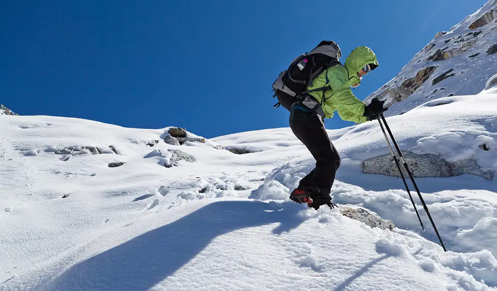
- Gears: Your gear should protect you from cold, wind, and harsh sun. Wear broken-in trekking boots, warm clothing layers, and a windproof/waterproof jacket. Using trekking poles helps reduce pressure on your knees, especially when descending. Take sunscreen, a sunhat, and a headlamp as well.
- Extras: Pack a first aid kit with your essentials and personal medications. Bring UV-protective sunglasses to shield your eyes, gloves, and a waterproof hat to stay warm in cold conditions.
- Mental Preparation: Break the trek into smaller, manageable sections and take a moment to celebrate each milestone. Enjoy the small comforts and chat with fellow trekkers/guides to create meaningful connections.
Everest Base Camp Trek Distance, itinerary, altitude, trekking time, and difficulty level
Day 1: Lukla to Phakding
The day starts with a short but steady descent from Lukla into a quiet forested valley. You will cross numerous suspension bridges and follow the path along the Dudh Koshi River. The path is rocky but easy to follow. You will walk through a few small Sherpa villages and get a gentle introduction to altitude trekking. Today’s trek will help your legs adjust to the terrain and thinning air.
- Starting altitude: 2,860 m (9,383 ft)
- Ending altitude: 2,610 m (8,562 ft)
- Distance: 9 km (5.6 mi)
- Trekking time: About 4 hours
- Elevation change: 250 m descent
- Difficulty: Moderate
- Trail type: Forested river valley with a few rocky sections
- Standard rest stops: Benkar or Phakding for tea or lunch
- Highlights: First views of Everest peaks, scenic suspension bridges, traditional Sherpa villages along the Dudh Koshi River
Day 2: Phakding to Namche Bazaar
The trail climbs as you start walking towards Namche Bazaar. Some steep stone steps include a long uphill trail and many suspension bridges. You will walk through the village of Monjo and arrive at the Sagarmatha National Park. Show your permit to enter the area. The final ascent to Namche is challenging. You can see Everest, Ama Dablam, and Nuptse on clear days from your trail. Namche Bazaar is famous as a bustling trading town. The bakeries, shops, and vibrant Sherpa culture welcome you. This town is a trek’s highlight and an ideal resting place to explore.
- Starting altitude: 2,610 m (8,562 ft)
- Ending altitude: 3,440 m (11,286 ft)
- Distance: 12 km (7.5 mi)
- Trekking time: About 6 hours
- Elevation change: 830 m ascent
- Difficulty: Challenging
- Trail type: Rocky paths, steep uphill sections, and multiple suspension bridges
- Standard rest stops: Monjo or Jorsale for tea or lunch.
- Highlights: Entry to Sagarmatha National Park, scenic river crossings, glimpses of Everest and Ama Dablam, arrival in the bustling Sherpa town of Namche
Day 3: Acclimatization in Namche Bazaar
Today is an acclimatizing day. You will spend the day adjusting to the highest altitude. You can take a short hike to the Everest View Hotel or climb the nearby mountain ridges. Going on these short hikes to a higher elevation helps the body adjust to the increasing altitude. The trail is easier, with few uphill stone steps being the only challenge. You will get great views of Everest, Lhotse, and Ama Dablam. After the hike, you are free to do what you want. Explore the bustling Namche Bazaar, and if it is Saturday, you can also visit the weekly farmers’ market.
- Starting altitude: 3,440 m (11,286 ft)
- Ending altitude: 3,440 m (11,286 ft)
- Distance: 0 km (rest day)
- Trekking time: Light walking is optional
- Elevation change: None
- Difficulty: Easy
- Trail type: Optional short hikes on stone steps, some steep sections
- Standard rest stops: Everest View Hotel, local tea houses.
- Highlights: Stunning views of Everest, Lhotse, Ama Dablam, exploring Sherpa culture and markets
Day 4: Namche Bazaar to Tengboche
The trail will ascend from Namche Bazaar to Tengboche. The path climbs steeply through rhododendron forests and crosses a high ridge. A broad valley will come into view after crossing the ridge. Tengboche is a significant place in the trek. Famous for its monastery, Tengboche serves as the spiritual center of the region. You can get lovely views of Ama Dablma during sunrise behind the monastery in clear mornings. Dress warmly, as snow often covers the trail here.
- Starting altitude: 3,440 m (11,286 ft)
- Ending altitude: 3,860 m (12,664 ft)
- Distance: 11 km (~6.8 mi)
- Trekking time: ~5 hours
- Elevation gain: 420 m
- Difficulty: Moderate
- Trail: Steep climbs through rhododendron forest, ridge crossing, open valley
- Standard rest stops: Tea houses at Kyanjuma and Phunki.
- Highlights: Tengboche Monastery, sunrise views of Ama Dablam and Everest, occasional snow on the trail
Day 5: Tengboche to Dingboche
Today, the trail follows the Imja Khola valley. It rises and falls through forests and moraine. You will cross rocky streams and pass the village of Pangboche, famous for its shrine. The air becomes thinner, and you can see Island Peak and Lhotse nearby. You can see glaciers and prayer flags coming in.
- Starting altitude: 3,860 m (12,664 ft)
- Ending altitude: 4,360 m (14,305 ft)
- Distance: 8 km (~5.0 mi)
- Trekking time: ~4 hours
- Elevation gain: 500 m
- Difficulty: Moderate
- Trail: Rocky path with river crossings over moraines
- Standard rest stops: Tea houses at Pangboche.
- Highlights: Close-up views of Everest and Ama Dablam, prayer flags along the trail
Day 6: Acclimatization in Dingboche
Today is the next acclimatization day. Take a short hike to the nearby Nangkartshang hill of 5,140m. The short trip helps increase red blood cells, ultimately adjusting your body to the altitude. Return to Dingboche for the day and rest. You can enjoy hot soup and relax in the afternoon.
- Starting altitude: 4,360 m (14,305 ft)
- Ending altitude: 5,140 m (16,864 ft)
- Distance: 6 km (~3.7 mi)
- Trekking time: ~4 hours
- Elevation gain: 780 m
- Difficulty: Challenging
- Trail: Steep rocky climb on stone steps
- Standard rest stops: Chhukung or back at Dingboche.
- Highlights: Views from Nangkartshang Hill, 360-degree panorama of peaks
Day 7: Dingboche to Lobuche
You ascend higher, gradually climbing past Dudghla. You see the expanding views of glaciers and towering peaks. The trail drops briefly into a small valley after passing Dudhla. Then, you climb the final steep to Lobuche. Snow covers Lobuche, and the air is thin. Lobuche village is at ~4,940m, where trekkers stay in either teahouses or lodges on the edge of the Khumbu glacier.
- Starting altitude: 4,360 m (14,305 ft)
- Ending altitude: 4,940 m (16,210 ft)
- Distance: 10 km (~6.2 mi)
- Trekking time: ~5 hours
- Elevation gain: 580 m
- Difficulty: Challenging
- Trail: Rocky, loose moraine near glaciers
- Standard rest stops: Dughla.
- Highlights: Views of Nuptse and the Khumbu Glacier, memorials to climbers
Day 8: Lobuche to Everest Base Camp to Gorak Shep
Today, you walk to Everest Base Camp from Lobuche and return to Gorakshep. The trail follows the rocky moraine of Khumbu Glacier along uneven paths and icy sections. You will reach Gorakshep, have lunch, rest, and continue the hike. A final push through a rocky trail will take you to the Everest Base Camp at 5,364m. You can celebrate your win here, then descend back to Gorak Shep, your stop for the night. Today is the most challenging trek due to the high altitude, distance, and trail conditions.
- Starting altitude: 4,940 m (16,210 ft)
- Ending altitude: 5,164 m (16,942 ft)
- Distance: 12 km (~7.5 mi)
- Trekking time: ~7 hours
- Elevation gain: 254 m
- Difficulty: Strenuous
- Trail: Glacial moraine, rocky and icy near Base Camp
- Standard rest stops: Gorak Shep tea houses.
- Highlights: Mount Everest Base Camp, Khumbu Icefall, prayer-flag campsite
Day 9: Gorak Shep to Kala Patthar to Pheriche
Today, you begin the hike pre-dawn to Kala Patthar at 5,545m, a famous sunrise viewpoint. The trail is steep, rocky, and demanding. The views of Golden Huw across the white peaks are extraordinary and worth the hike. You will descend to Gorakshep, have breakfast, and then reach Pheriche. The trail leads through the broad open valleys and rejoins the main trail near Tengbohcer. The descent is lengthy but easier due to the decreasing altitude.
- Starting altitude: 5,164 m (16,942 ft)
- Ending altitude: 4,370 m (14,337 ft)
- Distance: 15 km (~9.3 mi)
- Trekking time: ~8 hours
- Elevation change: Steep ascent to Kala Patthar, then descent of 794 m
- Difficulty: Strenuous
- Trail: Rocky path with an early climb to Kala Patthar, followed by a long descent
- Standard rest stops: Gorak Shep or Pheriche.
- Highlights: Sunrise views from Kala Patthar, sweeping panoramas of Everest and nearby peaks.
Day 10: Pheriche to Namche Bazaar
The trail goes downhill through forests and villages towards Namche. You descend the long stone staircases, with the occasional views of Ama Dablam and other peaks. There are nearby temples and traditional villages on the path, like Khumjung. You will start feeling warmer with the decreasing altitude. You will reach Namche by the afternoon.
- Starting altitude: 4,370 m (14,337 ft)
- Ending altitude: 3,440 m (11,286 ft)
- Distance: 15 km (~9.3 mi)
- Trekking time: ~7 hours
- Elevation change: Descent of 930 m
- Difficulty: Moderate
- Trail: Forested descent with stone steps and a few steep areas
- Standard rest stops: Khumjung.
- Highlights: Clear views of Ama Dablam and a return to greener, lower-altitude villages
Day 11: Namche Bazaar to Lukla
Today, there is a long and demanding descent from Namche to Lukla. You will lose elevation steadily and pass through forests, farm fields, and small villages. The hike is long and goes through many stone steps, making it physically demanding. You will walk through Phakding and Monjo and cross many suspension bridges. You will reach Lukla by evening.
- Starting altitude: 3,440 m (11,286 ft)
- Ending altitude: 2,860 m (9,383 ft)
- Distance: 20 km (~12.4 mi)
- Trekking time: ~9 hours
- Elevation change: Descent of 580 m
- Difficulty: Challenging
- Trail: Long downhill walk with rocky steps and forested sections
- Standard rest stops: Phakding or Monjo.
- Highlights: Final mountain views and farewell to Sherpa villages
Day 12: Fly to Kathmandu
You will board a flight from Lukla back to Kathmandu. Enjoy the aerial views of the Himalayan peaks like Everest, Lhotse, and others. Relax and recover from the trek. The trek ends officially today.
- Starting altitude: 2,860 m (9,383 ft)
- Ending altitude: 1,350 m (4,429 ft)
- Distance: 0 km (by air)
- Trekking time: ~20 minutes (flight duration)
- Elevation change: Descent of 1,510 m
- Difficulty: Easy
- Trail: Scenic mountain flight from Lukla to Kathmandu
- Standard rest stops: In Kathmandu.
- Highlights: Aerial views of the Himalayas and return to city comforts
Factors Influencing Daily Distances
Many factors influence how far you can reach each day. Here are the key ones:
- Altitude: The oxygen level drops as the altitude increases. Each step requires much effort above 4,000m. Your pace slows naturally due to the high elevation. Trekking days are shorter in high altitudes for safe acclimatization.
- Terrain: The trail plays a significant role in the trek. Rocky, steep, or icy sections mean you will walk more slowly with caution. You will naturally walk faster if the trail is flat through the forest and open valleys. Glacial moraines and loose rock fields also require extra time and caution.
- Weather: Clear mornings are the best time to cover more distance before the afternoon picks up wind and clouds roll in. Snow, rain, and strong winds will beat you. Poor weather may even block the trail, leading to unexpected rest days.
- Acclimatization: Good acclimatization helps prevent altitude sickness and makes the trek more enjoyable. This itinerary includes two rest stops for acclimatization. These acclimatization days help the body get used to the elevation.
Book your trek with us
Ready for the Everest Base Camp trek? Our professional guides are familiar with the trails and manage everything, including flights and permits. We arrange the best lodges, meals, and staff for your comfort. We customize the itinerary to fit your preference, ensuring a smooth and enjoyable trek and allowing you to walk at your own pace.